
IMAGES TAKEN NEAR TO
Arnold Avenue, SOUTHWELL, NG25 0BP
Introduction
This page details the photographs taken nearby to Arnold Avenue, NG25 0BP by members of the Geograph project.
The Geograph project started in 2005 with the aim of publishing, organising and preserving representative images for every square kilometre of Great Britain, Ireland and the Isle of Man.

There are currently over 7.5m images from over14,400 individuals and you can help contribute to the project by visiting https://www.geograph.org.uk
Image Map
Images are licensed for reuse under creativecommons.org/licenses/by-sa/2.0
Notes
- Clicking on the map will re-center to the selected point.
- The higher the marker number, the further away the image location is from the centre of the postcode.
Image Listing (70 Images Found)
Images are licensed for reuse under creativecommons.org/licenses/by-sa/2.0
Image
Details
Distance
1
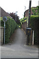
Urban footpath
Leading from The Ropewalk to Arnold Avenue and Leeway Road
Image: © Alan Murray-Rust
Taken: 19 Jun 2008
0.07 miles
2
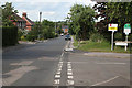
The Ropewalk
Looking towards Lower Kirklington Road. This is a main route for west to east traffic with the implementation of a one way system in the town centre
Image: © Alan Murray-Rust
Taken: 19 Jun 2008
0.08 miles
3
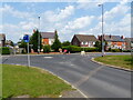
Roundabout at the junction of the Ropewalk with Lower Kirklington Rd, Southwell
Image: © Ruth Sharville
Taken: 22 Jul 2021
0.09 miles
4
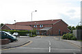
Southwell Medical Centre
A new development on The Ropewalk next to the Co-op store
Image: © Alan Murray-Rust
Taken: 19 Jun 2008
0.13 miles
5
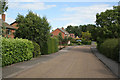
Monckton Drive
Modern housing development. This road also forms path of the network of pedestrian routes to the town centre.
Image: © Alan Murray-Rust
Taken: 19 Jun 2008
0.14 miles
6
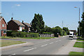
Lower Kirklington Road
Post war housing development along an old established road.
Image: © Alan Murray-Rust
Taken: 9 Jun 2008
0.14 miles
7
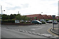
Cooperative store
Southwell's superstore. Although looking like a typical out-of-centre store, it is in fact remarkably close to the centre of the old town.
Image: © Alan Murray-Rust
Taken: 19 Jun 2008
0.17 miles
8
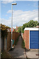
Footpath from Kings Court to Manor Court
One of the network of urban footpaths in this town, probably perpetuating routes that existed before the modern housing was built.
Image: © Alan Murray-Rust
Taken: 19 Jun 2008
0.18 miles
9
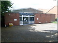
Southwell Telephone Exchange, Notts
Situated in The Ropewalk, this TE replaced the one adjacent to it in the early 1970s. That building is now a dental care centre. Besides Southwell, this TE also serves Halam, Halloughton, Hockerton, Kirklington, Rolleston and Upton nearby. It has (01636) 81xxxx numbers and its postcode is NG25 0AL.
Image: © David Hillas
Taken: 10 Jul 2010
0.18 miles
10
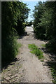
Footpath crossing
This footpath, which is clearly an old field access track, now overtaken by housing development. crosses the Southwell Trail at this point.
Image: © Alan Murray-Rust
Taken: 9 Jun 2008
0.19 miles