
IMAGES TAKEN NEAR TO
Daleside Road, NOTTINGHAM, NG2 4DH
Introduction
This page details the photographs taken nearby to Daleside Road, NG2 4DH by members of the Geograph project.
The Geograph project started in 2005 with the aim of publishing, organising and preserving representative images for every square kilometre of Great Britain, Ireland and the Isle of Man.

There are currently over 7.5m images from over14,400 individuals and you can help contribute to the project by visiting https://www.geograph.org.uk
Image Map
Images are licensed for reuse under creativecommons.org/licenses/by-sa/2.0
Notes
- Clicking on the map will re-center to the selected point.
- The higher the marker number, the further away the image location is from the centre of the postcode.
Image Listing (110 Images Found)
Images are licensed for reuse under creativecommons.org/licenses/by-sa/2.0
Image
Details
Distance
1
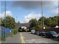
Trent Lane
The bridge in the middle distance is redundant; it probably used to carry a spur line to the main railway line, which runs the other side of the bridge.
Image: © Oxymoron
Taken: 3 Sep 2008
0.08 miles
2

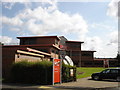
Rosehill Waterside School, Trent Lane (2)
According to an article in the Nottingham Post (21/12/2025), it was built as a mainstream school ('Waterside Primary Academy'), intended to serve an expanding residential area, but due to low pupil numbers the City Council has converted the school to accommodate children with Special Educational Needs and Disabilities (SEND).
Image: © Stephen Craven
Taken: 2 Jun 2026
0.09 miles
4
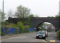
Nottingham Suburban Railway bridge over Trent Lane
The last addition, in 1889, to the complex railway infrastructure at Trent Lane was the Nottingham Suburban Railway, which left and joined the Great Northern at Trent Lane Junction. Southbound Suburban Railway trains from Daybrook crossed the Midland’s Lincoln and the GNR’s Grantham lines on girder bridges east of Trent Lane before dropping down to cross it on this arched blue-brick bridge, the most substantial surviving relic of the NSR, which lost its passenger service in 1916. The NSR then re-crossed the Lincoln line on a truss girder bridge before continuing to London Road; the girder bridge sat on the abutment on the left of the picture, behind the lamp post. The NSR continued to serve brickworks at Mapperley and Thorneywood until 1951; those trains used the northern junction at Daybrook as this southern section had been abandoned after being damaged by bombing in 1941. In Sneinton little remains of the Great Northern and the NSR apart from London Road Station (now a health club) and the derelict goods warehouses near it, the remains of the bridges at Meadow Lane and the bridge and abutments here.
See Image], Image], Image], Image], Image], Image], Image] and others.
Image: © John Sutton
Taken: 15 Apr 2011
0.10 miles
5

Oriental Mart, Trent Lane
A food wholesaler.
Image: © Stephen Craven
Taken: 2 Jun 2026
0.11 miles
6
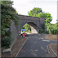
Nottingham Suburban Railway bridge over Trent Lane
A view from the ramp up to the new footbridge over the former Midland Railway line to Lincoln, now used by all eastbound trains leaving Nottingham. For more about the NSR bridge and other railway remains at Trent Lane, see Image
Image: © John Sutton
Taken: 22 Aug 2013
0.11 miles
7
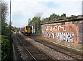
Lincoln train approaching Trent Lane
The blue-brick abutment to the right of the train is one of the remains of the Nottingham Suburban Railway's Bridge No 1. The larger stone-and-brick abutment covered with idiot scribblings once supported the huge girder bridge which carried the Great Northern Nottingham to Grantham line over the Midland Railway's Lincoln line. All eastbound trains now use the Midland route as far as Netherfield, where the Lincoln and Grantham lines part.
Image: © John Sutton
Taken: 20 Apr 2012
0.11 miles
8

Trent Villas, Trent Lane
The name suggests this was a desirable Victorian residence. But early 20th century maps show it was a lodge or manager's house associated with the city's sewage pumping station (a building later used, according to a 1954 map, as a sausage casings factory).
Image: © Stephen Craven
Taken: 2 Jun 2026
0.11 miles
9
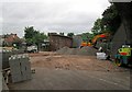
Trent Lane: work on a new footbridge
The foot crossing at Trent Lane is to be replaced by a footbridge as part of the reconfiguration and resignalling of Nottingham Midland Station and its approaches. Straight ahead is the southern abutment of the girder bridge which once carried the Great Northern Railway line from Grantham to Nottingham (shown from another angle in Image]). This picture was taken from under the old Nottingham Suburban Railway bridge (see Image]), part of whose blue-brick arch and wing wall show on the right. The crossing and associated footpaths are currently closed - determined pedestrians are diverted to Meadow Lane Level Crossing.
Image: © John Sutton
Taken: 13 Jun 2013
0.12 miles
10
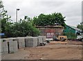
Trent Lane: foot crossing replacement
The foot crossing is to be replaced by a footbridge as part of the reconfiguration and resignalling of Nottingham Midland Station and its approaches. Straight ahead is the northern abutment of the bridge which once carried the Great Northern Railway line from Grantham to Nottingham (shown from other angles in Image] and Image]). The crossing and associated footpaths are currently closed - determined pedestrians are diverted to Meadow Lane Level Crossing.
Image: © John Sutton
Taken: 13 Jun 2013
0.12 miles