IMAGES TAKEN NEAR TO
Village Close, NEWARK, NG24 4SY
Introduction
This page details the photographs taken nearby to Village Close, NG24 4SY by members of the Geograph project.
The Geograph project started in 2005 with the aim of publishing, organising and preserving representative images for every square kilometre of Great Britain, Ireland and the Isle of Man.

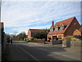
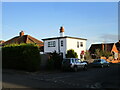
There are currently over 7.5m images from over14,400 individuals and you can help contribute to the project by visiting https://www.geograph.org.uk
Image Map
Images are licensed for reuse under creativecommons.org/licenses/by-sa/2.0
Notes
- Clicking on the map will re-center to the selected point.
- The higher the marker number, the further away the image location is from the centre of the postcode.
Image Listing (15 Images Found)
Images are licensed for reuse under creativecommons.org/licenses/by-sa/2.0
Image
Details
Distance
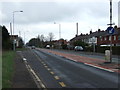
1
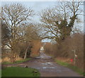
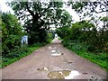
Long Lane
An old established lane giving access to riverside fields to the north of Farndon village, developed from the 1930s onwards as a suburban area of Newark.
Image: © Alan Murray-Rust
Taken: 27 Nov 2009
0.06 miles
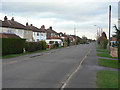
2
Marsh Lane
Originally a lane giving access to local fields, Marsh Lane has been built up to become a suburban dormitory for Newark. In the distance can be seen the tower of the old windmill.
Image: © Alan Murray-Rust
Taken: 27 Nov 2009
0.10 miles
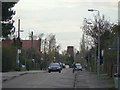
4
Long Lane, Farndon
Looking north from Marsh Lane.
Image: © Richard Vince
Taken: 16 Mar 2014
0.12 miles
5
2a Linton Close, Farndon
Modernist house.
Image: © Jonathan Thacker
Taken: 1 Dec 2020
0.15 miles
7

Farndon, Notts.
The rear of Farndon Primary School and playing field from a footpath linking the River Trent and Marsh Lane in the village.
Image: © David Hallam-Jones
Taken: 16 Jan 2016
0.18 miles
8
Farndon, Notts.
The track ahead and behind the photographer, known as Long Lane, connects the south bank of the River Trent - opposite Staythorpe C Power Station - with Walter's Close, a cul-de-sac off Marsh Lane (Farndon's principal through-route).
Image: © David Hallam-Jones
Taken: 16 Jan 2016
0.20 miles
9
Track from Farndon
This track rus in almost a straight line from Farndon to the River Trent for about 1 mile
Image: © Andrew Tatlow
Taken: 14 Sep 2006
0.20 miles