IMAGES TAKEN NEAR TO
Bowbridge Lane, NEWARK, NG24 3BY
Introduction
This page details the photographs taken nearby to Bowbridge Lane, NG24 3BY by members of the Geograph project.
The Geograph project started in 2005 with the aim of publishing, organising and preserving representative images for every square kilometre of Great Britain, Ireland and the Isle of Man.

There are currently over 7.5m images from over14,400 individuals and you can help contribute to the project by visiting https://www.geograph.org.uk
Image Map
Images are licensed for reuse under creativecommons.org/licenses/by-sa/2.0
Notes
- Clicking on the map will re-center to the selected point.
- The higher the marker number, the further away the image location is from the centre of the postcode.
Image Listing (29 Images Found)
Images are licensed for reuse under creativecommons.org/licenses/by-sa/2.0
Image
Details
Distance
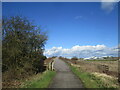
1
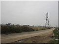
Diversion of Bowbridge Lane
The original route of Bowbridge Lane can be seen crossing the photograph. This is now fenced off and replaced by a diverted Bowbridge Lane which connects into the Newark Southern Relief Road which is at present under construction.
Image: © Jonathan Thacker
Taken: 3 Feb 2017
0.07 miles
4
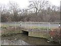
Bow Bridge
Crosses the Middle Beck.
Presumably the original bridge was hump backed, hence the name.
Image: © Jonathan Thacker
Taken: 28 Feb 2019
0.10 miles
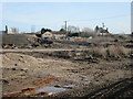
5
Track to Quarry Farm and various industrial premises
The rather squalid urban fringe of Newark. The area has been subjected to gypsum mining and processing for almost two hundred years though there are no longer any active workings in the immediate vicinity.
Image: © Jonathan Thacker
Taken: 28 Feb 2019
0.12 miles
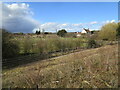
6
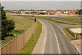
New road & new housing
View NW from NCN Route 64 overbridge
Image: © Richard Croft
Taken: 23 May 2019
0.12 miles
7
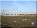
View towards the Newark Southern Relief Road
The road is not yet open but Bowbridge Lane has been diverted to connect with it at a roundabout which is at the extreme left of the picture.
Image: © Jonathan Thacker
Taken: 3 Feb 2017
0.13 miles
8
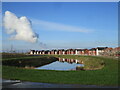
Balancing pond and new housing, Middlebeck
Image: © Jonathan Thacker
Taken: 5 Dec 2020
0.14 miles
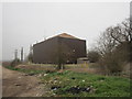
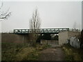
9
Bridge over the Newark Southern Relief Road
Carries National Cycle Route 64.
Image: © Jonathan Thacker
Taken: 12 Mar 2021
0.14 miles
10
Bridge over the link road
Carries Cycleway 64.
Image: © Jonathan Thacker
Taken: 28 Nov 2020
0.14 miles