
IMAGES TAKEN NEAR TO
St. Marks Lane, NEWARK, NG24 1XS
Introduction
This page details the photographs taken nearby to St. Marks Lane, NG24 1XS by members of the Geograph project.
The Geograph project started in 2005 with the aim of publishing, organising and preserving representative images for every square kilometre of Great Britain, Ireland and the Isle of Man.

There are currently over 7.5m images from over14,400 individuals and you can help contribute to the project by visiting https://www.geograph.org.uk
Image Map
Images are licensed for reuse under creativecommons.org/licenses/by-sa/2.0
Notes
- Clicking on the map will re-center to the selected point.
- The higher the marker number, the further away the image location is from the centre of the postcode.
Image Listing (1441 Images Found)
Images are licensed for reuse under creativecommons.org/licenses/by-sa/2.0
Image
Details
Distance
1
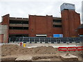
St Mark's Multi-storey Car Park, Newark
Dates from the mid 1970s and now exposed by the demolition of the former Marks and Spencer store.
Image: © Jonathan Thacker
Taken: 7 Aug 2024
0.01 miles
2
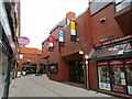
St. Mark's Lane, Newark
Redeveloped in the late 1970s and providing a pedestrian route from Lombard Street to the Market Place.
Image: © Jonathan Thacker
Taken: 30 Dec 2020
0.02 miles
3
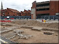
Remains of Newark past
The former Marks and Spencer store is being redeveloped and archaeological investigations are taking place prior to the new construction.
Image: © Jonathan Thacker
Taken: 7 Aug 2024
0.02 miles
4
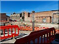
Development site off St Mark's Lane, Newark
New retail units and 29 dwellings are to be erected on the site.
Archaelogical surveys have discovered Anglo Saxon remains here.
Image: © Jonathan Thacker
Taken: 19 Jul 2024
0.02 miles
5
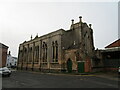
Former Christ Church, Newark from the north east
The apse appears almost as a low tower. Built 1836-7 and designed by W.A.Nicholson https://en.wikipedia.org/wiki/William_Adams_Nicholson It is not oriented. The church closed in 1957 being replaced by a new building in the suburbs Image It is now a furniture store. https://historicengland.org.uk/listing/the-list/list-entry/1196270
Image: © Jonathan Thacker
Taken: 30 Dec 2020
0.03 miles
6
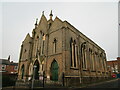
Former Christ Church, Newark
Built 1836-7 and designed by W.A.Nicholson https://en.wikipedia.org/wiki/William_Adams_Nicholson It is not oriented. The church closed in 1957 being replaced by a new building in the suburbs Image It is now a furniture store. https://historicengland.org.uk/listing/the-list/list-entry/1196270
Image: © Jonathan Thacker
Taken: 30 Dec 2020
0.03 miles
7
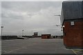
Car park
The roof of the multistorey car park at St Marks
Image: © Bob Harvey
Taken: 15 Oct 2015
0.04 miles
8
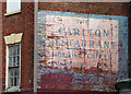
Ghost sign, Lombard Street, Newark-on-Trent
Advertising the Carlton Restaurant, "morning coffee, luncheons, teas".
Image: © Stephen Richards
Taken: 21 Jun 2012
0.04 miles
9
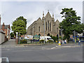
Former Christ Church
Anglican church of 1836, architect J D Paine, which became redundant towards the latter part of the 20th century and was converted around 1987 to a furniture warehouse. Listed Grade II.
Image: © Alan Murray-Rust
Taken: 31 Aug 2012
0.04 miles
10
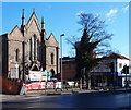
Lombard Street, Newark, Notts.
A former church, opposite the entrance to the town's bus station, is now being used as an antique centre.
Image: © David Hallam-Jones
Taken: 21 Nov 2015
0.04 miles