1
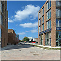
Building continues at Trent Bridge Quays
This is a housing development on the site of riverside warehouses. The blocks facing the River Trent are complete, but work continues on the last phase, on the other side of the site, opposite Notts County's Meadow Lane football ground.
Image: © John Sutton
Taken: 26 Sep 2022
0.01 miles
2
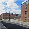
Quay Place, Trent Bridge Quays
Trent Bridge Quays is a housing development on a brownfield site between Meadow Lane (ahead) and the River Trent. The final phase of building and landscaping continues on the Meadow Lane side of the site.
Image: © John Sutton
Taken: 18 May 2023
0.01 miles
3
From Meadow Lane to the City Ground
The Trent End of Nottingham Forest's ground is in the centre of the picture on the other side of the river. Those arriving for Notts County's match against Barnet had better things to do than look in that direction.
The land now used for car parking was once occupied by Trent Navigation warehouses. It is to be developed as riverside housing, to be known as Trent Bridge Quays.
Image: © John Sutton
Taken: 14 Oct 2017
0.02 miles
4
Piling on the Trent Bridge Quays site
The site was formerly occupied by Trent Navigation warehouses and a bus park and is now to be developed as housing. Notts County's Meadow Lane football ground is in the background.
Image: © John Sutton
Taken: 19 Sep 2019
0.03 miles
5
Meadow Lane: the site of Trent Bridge Quays
A brownfield site between Meadow Lane and the River Trent is to be developed with "95 exceptional residencies" (houses and flats, presumably).
Image: © John Sutton
Taken: 15 Jul 2019
0.03 miles
6
Meadow Lane: Trent Bridge Quays
This is one of the first completed blocks of the Trent Bridge Quays estate, which is going up on a brownfield site between Meadow Lane and the River Trent. The people in the picture are leaving Meadow Lane football ground having seen Notts County beat Aldershot Town 3-2 in a National League match.
Image: © John Sutton
Taken: 4 Sep 2021
0.03 miles
7
Trentside to Meadow Lane
A view through the new Trent Bridge Quays housing development from the left bank of the River Trent towards Notts County's football ground, Meadow Lane. These houses and flats ("riverside living") occupy a brownfield site once occupied by British Waterways warehouses.
Image: © John Sutton
Taken: 29 Apr 2022
0.03 miles
8
At Trent Bridge Quays
This development between Meadow Lane and the River Trent is nearing completion and some of the houses are occupied or sold.
Image: © John Sutton
Taken: 28 Jun 2022
0.03 miles
9
The Trent Bridge Quays building site
The site was formerly occupied by Trent Navigation warehouses and a bus park and is now to be developed as housing. The sound track to this picture is the heavy, repeated thump of the piler in the centre driving concrete beams into the ground.
Image: © John Sutton
Taken: 19 Sep 2019
0.03 miles
10
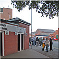
Meadow Lane: meeting before the match
Notts County fans meeting under the horse chestnut tree at the Meadow Lane end of the ground before a 1-1 draw with Leyton Orient.
Image: © John Sutton
Taken: 16 Sep 2014
0.04 miles


