
IMAGES TAKEN NEAR TO
Queens Road, NOTTINGHAM, NG2 3AS
Introduction
This page details the photographs taken nearby to Queens Road, NG2 3AS by members of the Geograph project.
The Geograph project started in 2005 with the aim of publishing, organising and preserving representative images for every square kilometre of Great Britain, Ireland and the Isle of Man.

There are currently over 7.5m images from over14,400 individuals and you can help contribute to the project by visiting https://www.geograph.org.uk
Image Map
Images are licensed for reuse under creativecommons.org/licenses/by-sa/2.0
Notes
- Clicking on the map will re-center to the selected point.
- The higher the marker number, the further away the image location is from the centre of the postcode.
Image Listing (1208 Images Found)
Images are licensed for reuse under creativecommons.org/licenses/by-sa/2.0
Image
Details
Distance
1
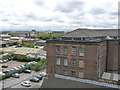
View from the car park - towards Trent Bridge
The new Queens Road multi-storey car park has opened up new views of the City. The former textile factory is now in use as a personal storage depot. The floodlights of the Trent Bridge grounds of Nottingham Forest Football Club and Nottinghamshire County Cricket Club can be seen in the distance.
Image: © Alan Murray-Rust
Taken: 18 Jul 2012
0.02 miles
2
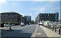
Queen's Road
Once a road of hosiery warehouses, Queen's Road is now dominated by the new multi-storey car park on the right and the offices to the left. Image] (May 2011) shows things before work on the car park and the tramway bridge had begun.
Image: © John Sutton
Taken: 29 Apr 2014
0.02 miles
3

Meadows Mill, Queen's Road, Nottingham
Monumental enough but this is only the short side, as seen from Summer Leys Lane. The main Queen's Road front is at least twice as long. By Thomas Chambers Hine, c1865, raised in 1874 and enlarged in 1887. Grade II listed.
Originally a cotton warehouse, then lace, now a self-storage facility for people who can't fit all their possessions in poky modern flats.
Image: © Stephen Richards
Taken: 19 Jun 2012
0.02 miles
4
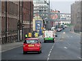
Along Queen's Road
A zoom shot from London Road, showing the changing face of Queen's Road. The huge grey tramway bridge is waiting to be moved into place across the railway station. The former Hicking Pentecost building, now flats, is on the left.
Image: © John Sutton
Taken: 10 Apr 2013
0.02 miles
5
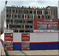
The first part of The Hub
The new multi-storey car park for Nottingham Station is nearing completion.
Image: © Alan Murray-Rust
Taken: 4 Dec 2011
0.03 miles
6
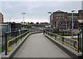
Nottingham Midland: new path to Queen's Road
This new path from Platform 7 to Queen's Road (ahead) is shown from above in David Hallam-Jones's Image], taken from the nearby multi-storey car park.
Image: © John Sutton
Taken: 26 Aug 2014
0.03 miles
7
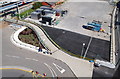
Pedestrian link, Nottingham Railway Station, NG1
A new link for pedestrians between the station and mid-way along Queen's Road (the A6019).
Image: © David Hallam-Jones
Taken: 23 Aug 2014
0.03 miles
8
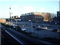
Car Park, Nottingham Station
View of car park and buildings beyond, from footbridge between platforms.
Image: © Michael Westley
Taken: 7 Mar 2010
0.04 miles
9
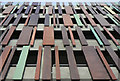
Copper cladding
A seemingly random arrangement of coppered panels is used to break up the façade of the new car park at Nottingham Station.
Image: © Alan Murray-Rust
Taken: 4 Dec 2011
0.04 miles
10
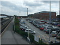
Car park Nottingham Railway Station
As viewed from the footbridge.
Image: © Richard Hoare
Taken: 7 May 2010
0.04 miles