
IMAGES TAKEN NEAR TO
Grassthorpe Road, NEWARK, NG23 6RG
Introduction
This page details the photographs taken nearby to Grassthorpe Road, NG23 6RG by members of the Geograph project.
The Geograph project started in 2005 with the aim of publishing, organising and preserving representative images for every square kilometre of Great Britain, Ireland and the Isle of Man.

There are currently over 7.5m images from over14,400 individuals and you can help contribute to the project by visiting https://www.geograph.org.uk
Image Map
Images are licensed for reuse under creativecommons.org/licenses/by-sa/2.0
Notes
- Clicking on the map will re-center to the selected point.
- The higher the marker number, the further away the image location is from the centre of the postcode.
Image Listing (5 Images Found)
Images are licensed for reuse under creativecommons.org/licenses/by-sa/2.0
Image
Details
Distance
1
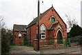
Normanton Methodist Church
Bold red brick Methodist church, looks late 19th century
Image: © Richard Croft
Taken: Unknown
0.13 miles
2
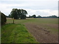
Footpath across fields south of Normanton on Trent
The path heads south from the corner in the lane at the edge of the village.
Image: © Andrew Hill
Taken: 18 Sep 2010
0.13 miles
3
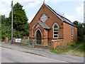
Former Wesleyan Methodist chapel, Normanton-on-Trent
Now converted into a dwelling, and known as Wesley Hall. The stone over the entrance doorway is dated 1896.
Image: © Alan Murray-Rust
Taken: 1 Aug 2014
0.14 miles
4
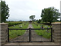
Cemetery at Normanton on Trent
This looks to be a new cemetery, not shown on the 2015 OS map.
Image: © Graham Hogg
Taken: 13 Jul 2015
0.18 miles
5
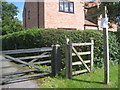
The beginning of the path to Low Marnham
From South Street, Normanton on Trent.
Image: © Jonathan Thacker
Taken: 28 Jul 2012
0.24 miles