IMAGES TAKEN NEAR TO
Orchard Park, NEWARK, NG23 5DQ
Introduction
This page details the photographs taken nearby to Orchard Park, NG23 5DQ by members of the Geograph project.
The Geograph project started in 2005 with the aim of publishing, organising and preserving representative images for every square kilometre of Great Britain, Ireland and the Isle of Man.

There are currently over 7.5m images from over14,400 individuals and you can help contribute to the project by visiting https://www.geograph.org.uk
Image Map
Images are licensed for reuse under creativecommons.org/licenses/by-sa/2.0
Notes
- Clicking on the map will re-center to the selected point.
- The higher the marker number, the further away the image location is from the centre of the postcode.
Image Listing (16 Images Found)
Images are licensed for reuse under creativecommons.org/licenses/by-sa/2.0
Image
Details
Distance
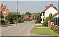
1
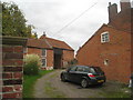
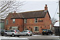
Barn in Long Bennington
Many buildings in Long Bennington exhibit lias stone walling as here in the lower parts of this barn. This stone is poor by comparison with the limestones of only a few miles away. Other examples of its use can be found in several villages around Newark on Trent including Collingham, Langford, Dry Doddington and Westborough.
Image: © Jonathan Thacker
Taken: 22 Oct 2010
0.05 miles
2
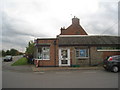
Sienna's, Long Bennington
What a delight ! A real mixture of textures. Modern brick, plastic door and windows, a corrugated roof and even some lias walling. I presume that this building was originally an outhouse to the house behind it.
Image: © Jonathan Thacker
Taken: 22 Oct 2010
0.08 miles
3
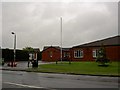
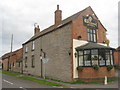
St James village hall Long Bennington
Very near the A1 south.
Image: © Steve Fareham
Taken: 27 May 2008
0.09 miles
6
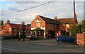
The Wheatsheaf, Long Bennington
Many buildings in Long Bennington exhibit lias stone walling though rarely to the full height of the building as here. This stone is poor by comparison with the limestones of only a few miles away. Other examples of its use can be found in several villages around Newark on Trent including Collingham, Langford, Dry Doddington and Westborough.
Image: © Jonathan Thacker
Taken: 22 Oct 2010
0.11 miles
10
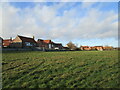
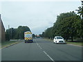
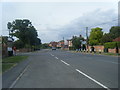
Grass field and housing, Long Bennington
Image: © Jonathan Thacker
Taken: 19 Dec 2020
0.14 miles