IMAGES TAKEN NEAR TO
Almond Court, NOTTINGHAM, NG2 2GE
Introduction
This page details the photographs taken nearby to Almond Court, NG2 2GE by members of the Geograph project.
The Geograph project started in 2005 with the aim of publishing, organising and preserving representative images for every square kilometre of Great Britain, Ireland and the Isle of Man.

There are currently over 7.5m images from over14,400 individuals and you can help contribute to the project by visiting https://www.geograph.org.uk
Image Map
Images are licensed for reuse under creativecommons.org/licenses/by-sa/2.0
Notes
- Clicking on the map will re-center to the selected point.
- The higher the marker number, the further away the image location is from the centre of the postcode.
Image Listing (241 Images Found)
Images are licensed for reuse under creativecommons.org/licenses/by-sa/2.0
Image
Details
Distance
1
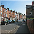
Wilford Crescent
Three-storey terraced houses typical of those built as Nottingham expanded rapidly in the last quarter of the 19th century.
Image: © John Sutton
Taken: 23 Aug 2015
0.02 miles
2
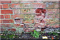
Benchmark on No. 13 Wilford Crescent West
Ordnance Survey cut mark benchmark described on the Bench Mark Database at www.bench-marks.org.uk/bm112060
Image: © Luke Shaw
Taken: 11 May 2019
0.04 miles
3
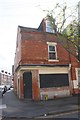
No. 13 Wilford Crescent West at Woolmer Road junction
There is an Ordnance Survey benchmark Image on the left hand side of the building
Image: © Luke Shaw
Taken: 11 May 2019
0.04 miles
4
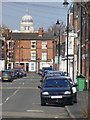
Beauvale Road
Typical traditional Meadows terraced street. Telephoto brings the dome of the Council House Image much closer than it really is.
Image: © Alan Murray-Rust
Taken: 20 Mar 2009
0.05 miles
5
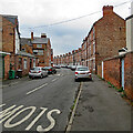
Along Wilford Crescent West
Three-storey terraced houses typical of Nottingham's Victorian inner suburbs.
Image: © John Sutton
Taken: 28 Jul 2022
0.06 miles
6
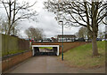
Pedestrian underpass under Robin Hood Way, Nottingham
Image: © habiloid
Taken: 17 Feb 2023
0.06 miles
7
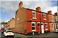
Glapton Road houses at Barnsley Terrace junction
There is an Ordnance Survey benchmark Image on the side of the house at the corner at the junction of the house and its side wall
Image: © Luke Shaw
Taken: 11 May 2019
0.07 miles
8
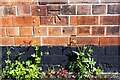
Benchmark on #34 Glapton Road (Barnsley Terrace face)
Ordnance Survey cut mark benchmark described on the Bench Mark Database at www.bench-marks.org.uk/bm112061
Image: © Luke Shaw
Taken: 11 May 2019
0.07 miles
9
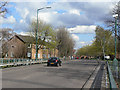
Robin Hood Way
One of the main distributor roads created as part of the redevelopment of the Meadows during the 1970s. The new road layout bore no relation to the old mass of terraced streets.
Image: © Alan Murray-Rust
Taken: 7 Apr 2009
0.09 miles