IMAGES TAKEN NEAR TO
Fairfield Park, Wellow Road, NEWARK, NG22 9FB

Introduction

This page details the photographs taken nearby to Fairfield Park, Wellow Road, NG22 9FB by members of the Geograph project.

The Geograph project started in 2005 with the aim of publishing, organising and preserving representative images for every square kilometre of Great Britain, Ireland and the Isle of Man.

There are currently over 7.5m images from over14,400 individuals and you can help contribute to the project by visiting https://www.geograph.org.uk

Image Map


Images are licensed for reuse under creativecommons.org/licenses/by-sa/2.0
Notes
  • Clicking on the map will re-center to the selected point.
  • The higher the marker number, the further away the image location is from the centre of the postcode.

Image Listing (14 Images Found)

Images are licensed for reuse under creativecommons.org/licenses/by-sa/2.0
Image
Details
Distance
1
Ollerton, Notts.
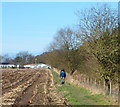
With the village of Wellow several miles behind the photographer, these are the last few metres of a rural footpath that terminates adjacent to one of the Fairfield (Mobile Homes) Park entrances ahead.
Image: © David Hallam-Jones Taken: 22 Feb 2015
0.05 miles
2
The Ollerton House
Image: © Graham Hogg Taken: 16 Nov 2015
0.07 miles
3
The Ollerton House
Public House located on the A616 Road in Ollerton.
Image: © Jonathan Clitheroe Taken: 2 Aug 2022
0.07 miles
4
The Ollerton House
A Mansfield Brewery leased pub
Image: © Chris Morgan Taken: 16 Nov 2015
0.08 miles
5
Ollerton, Notts.
This arable field-hugging footpath commences ( ...and/or terminates ...) ahead, adjacent to one of the entrances to the Fairfield Mobile Homes Park. This entrance to the mobile home park is at the end of a mile-long track called Middlefield. Access to Middlefield is from Back Lane, Ollerton.
Image: © David Hallam-Jones Taken: 22 Feb 2015
0.08 miles
6
Ollerton, Notts.
A new housing development to the east of the Ollerton House pub on the A616 (the Sheffield to Newark road). The existing houses are on School Lane, Ollerton, a road connecting the Fairfield Mobile Homes Park with the A616. This is a view from a rural footpath linking one of the Fairfield Park entrances with the village of Wellow.
Image: © David Hallam-Jones Taken: 22 Feb 2015
0.10 miles
7
Ollerton, Notts.
A track, a.k.a. Middlefield, ends here at one of two entrances to the Fairfield (Mobile Homes) Park. Ramblers proceeding in the direction of Wellow - across the surrounding countryside - need to follow the footpath behind the chest-high 'footpath marker' notice that can be seen in the centre of this picture.
Image: © David Hallam-Jones Taken: 22 Feb 2015
0.11 miles
8
Ollerton, Notts.
At the end of a mile-long track (known as Middlefield), i.e. behind the photographer, pedestrians and ramblers need to cross this railway bridge in order to pick-up a footpath towards Wellow. The commencement of the path, that skirts Fairfield Mobile Homes Park, is a few metres ahead on the other side of the bridge, adjacent to the entrance to the mobile home park.
Image: © David Hallam-Jones Taken: 22 Feb 2015
0.12 miles
9
Mineral railway at Ollerton
The line is still active but little used now following the closure of the collieries it served
Image: © Graham Hogg Taken: 16 Nov 2015
0.14 miles
10
The railway at Ollerton
Only one track seems to be in use - as a test track for Network Rail https://en.wikipedia.org/wiki/High_Marnham_Test_Track There is a campaign to reopen this line to passenger trains between Shirebrook Junction and a point a little to the east of where this photograph was taken. Stations would be provided at Warsop, Edwinstowe and Ollerton.
Image: © Jonathan Thacker Taken: 8 Mar 2020
0.16 miles