IMAGES TAKEN NEAR TO
Corkhill Lane, NEWARK, NG22 8NR
Introduction
This page details the photographs taken nearby to Corkhill Lane, NG22 8NR by members of the Geograph project.
The Geograph project started in 2005 with the aim of publishing, organising and preserving representative images for every square kilometre of Great Britain, Ireland and the Isle of Man.

There are currently over 7.5m images from over14,400 individuals and you can help contribute to the project by visiting https://www.geograph.org.uk
Image Map
Images are licensed for reuse under creativecommons.org/licenses/by-sa/2.0
Notes
- Clicking on the map will re-center to the selected point.
- The higher the marker number, the further away the image location is from the centre of the postcode.
Image Listing (11 Images Found)
Images are licensed for reuse under creativecommons.org/licenses/by-sa/2.0
Image
Details
Distance
1
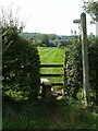
Footpath to Maythorne
Leaving Corkhill Lane near Middle Corkhill Farm.
Image: © Alan Murray-Rust
Taken: 13 Sep 2020
0.05 miles
2
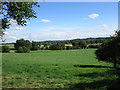
View towards Southwell
The towers of Southwell Minster visible in the centre of the picture.
Image: © Jonathan Thacker
Taken: 16 Jul 2017
0.10 miles
3
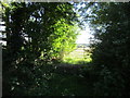
Sunlit gate
The beginning of a footpath to Mayfield on a hot Sunday afternoon.
Image: © Jonathan Thacker
Taken: 16 Jul 2017
0.13 miles
4
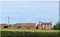
Middle Corkhill Farm, Normanton
One of three farms along the Cork Hill ridge, presenting itself as a predominantly 19th century farmstead.
Image: © Alan Murray-Rust
Taken: 13 Sep 2020
0.13 miles
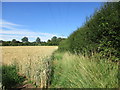
5
Footpath to Corkhill Lane
The correct route of the path is through the patch of nettles on the right. But a route (just visible) has been made through the centre of this overgrown field. Much pleasanter when wearing shorts!
Image: © Jonathan Thacker
Taken: 16 Jul 2017
0.13 miles
6
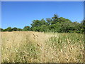
Path through the long grass
The official route of this path is thick with nettles so someone has chosen a route through the middle of this uncultivated field. It is just about identifiable by the green just showing.
Image: © Jonathan Thacker
Taken: 16 Jul 2017
0.13 miles
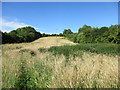
7
Field edge and power lines
A footpath to Corkhill Lane going off to the left.
Image: © Jonathan Thacker
Taken: 16 Jul 2017
0.17 miles
8
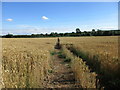
Footpath to Maythorne
Clearly cut through this field of wheat.
Image: © Jonathan Thacker
Taken: 16 Jul 2017
0.19 miles
9
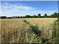
Footpath to Corkhill Lane
Clearly cut through this field of wheat.
Image: © Jonathan Thacker
Taken: 16 Jul 2017
0.19 miles
10
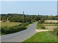
Corkhill Lane, Normanton
Looking towards Kirklington at the entry to Far Corkhill Farm.
Image: © Alan Murray-Rust
Taken: 13 Sep 2020
0.21 miles