IMAGES TAKEN NEAR TO
Farnsfield, NEWARK, NG22 8BP
Introduction
This page details the photographs taken nearby to NG22 8BP by members of the Geograph project.
The Geograph project started in 2005 with the aim of publishing, organising and preserving representative images for every square kilometre of Great Britain, Ireland and the Isle of Man.

There are currently over 7.5m images from over14,400 individuals and you can help contribute to the project by visiting https://www.geograph.org.uk
Image Map
Images are licensed for reuse under creativecommons.org/licenses/by-sa/2.0
Notes
- Clicking on the map will re-center to the selected point.
- The higher the marker number, the further away the image location is from the centre of the postcode.
Image Listing (15 Images Found)
Images are licensed for reuse under creativecommons.org/licenses/by-sa/2.0
Image
Details
Distance
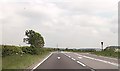
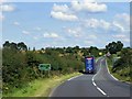
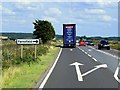
4
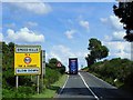
A617 at Lockwell Hill Activity Centre entrance
Image: © John Firth
Taken: 9 Jun 2013
0.09 miles
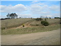
5
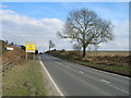
Arable land on Lockwell Hill
Looking west from near the junction of Cockett Road with the A617 Kirklington Road. A dump of rubbish over the hedge from the small lay-by the other side - an all-too-common sight for farmers these days.
Image: © Trevor Rickard
Taken: 7 Jan 2012
0.13 miles
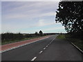
7
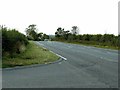
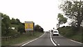
A617 near Bilsthorpe
Looking west at Cockett Lane
Image: © Alan Murray-Rust
Taken: 20 Sep 2020
0.15 miles