1
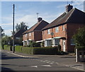
Houses on Triumph Road, Eakring
A village side street.
Image: © Andrew Hill
Taken: 8 Sep 2012
0.03 miles
2
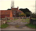
Lanes Farm, Eakring
Image: © Graham Hogg
Taken: 5 Jan 2016
0.04 miles
3
Kirklington Road, Eakring
A small village between Southwell and Ollerton, famous for having a residential training centre of National Grid plc, producing oil up to the 1960s and having a vicar called Mompesson, who came from the Plague village of Eyam in Derbyshire.
Image: © Peter Barr
Taken: 8 Oct 2013
0.05 miles
4
Houses on Triumph Road, Eakring
With a fine monkey puzzle tree to the right.
Image: © Neil Theasby
Taken: 15 Jan 2016
0.06 miles
5
Pond Farm, Kirklington Road, Eakring, Notts.
This Grade II-listed late-C18th and C19th farmhouse (with 4.5 acres of grounds including garden, paddocks, pond and agricultural buildings) is currently "For Sale". This is a view from Side Lane opposite. The centre of the village is 200-300 metres away to the left.
Image: © David Hallam-Jones
Taken: 16 Jan 2015
0.08 miles
6
Footbridge on the edge of Eakring.
Close to the Robin hoods way path.
Image: © steven ruffles
Taken: 27 Apr 2019
0.11 miles
7
Robin Hood Way, off Back Lane at Eakring
Image: © John Slater
Taken: 7 Jul 2018
0.13 miles
8
St Andrew's Church, Eakring, Notts.
The Grade II* listed Parish Church on the east side of Kirklington Road is seen here on the approach into the centre of the village. The current building dates back to the C13th, the oldest part being the tower which has a C13th base and a C15th top storey. The building was restored in Elizabethan times, next in the C17th century on the instruction of the Rev. William Mompesson, who widened the nave and added the two porches, and then again in 1881.
Image: © David Hallam-Jones
Taken: 16 Jan 2015
0.14 miles
9
St.Andrew's church, Eakring, Notts.
Image: © Richard Croft
Taken: Unknown
0.14 miles
10
Bench mark, St Andrew's Church, Eakring
See http://www.geograph.org.uk/photo/4024521 for location.
Image: © Alan Murray-Rust
Taken: 1 Jun 2014
0.16 miles


