
IMAGES TAKEN NEAR TO
Glaramara Close, NOTTINGHAM, NG2 1LD
Introduction
This page details the photographs taken nearby to Glaramara Close, NG2 1LD by members of the Geograph project.
The Geograph project started in 2005 with the aim of publishing, organising and preserving representative images for every square kilometre of Great Britain, Ireland and the Isle of Man.

There are currently over 7.5m images from over14,400 individuals and you can help contribute to the project by visiting https://www.geograph.org.uk
Image Map
Images are licensed for reuse under creativecommons.org/licenses/by-sa/2.0
Notes
- Clicking on the map will re-center to the selected point.
- The higher the marker number, the further away the image location is from the centre of the postcode.
Image Listing (391 Images Found)
Images are licensed for reuse under creativecommons.org/licenses/by-sa/2.0
Image
Details
Distance
1
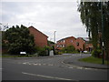
Ferngill Close, the Meadows
One of several residential cul de sacs off Robin Hood Way.
Image: © Richard Vince
Taken: 10 Jun 2013
0.03 miles
2
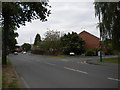
Robin Hood Way, the Meadows
Looking north, with Ferngill Close on the right.
Image: © Richard Vince
Taken: 10 Jun 2013
0.03 miles
3
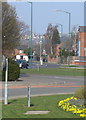
Robin Hood Way
This road was created on a completely new alignment as part of the redevelopment of the Meadows during the 1970s. This section roughly follows the southern end of Wilford Road, one of the main roads south, and part of the old tram network.
Image: © Alan Murray-Rust
Taken: 20 Mar 2009
0.04 miles
4
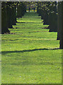
Sunlight on the grass
Avenue of mature trees on the west side of Queens Walk. Some of these may be lost to the proposed tram route, but there will be replacement planting.
Image: © Alan Murray-Rust
Taken: 7 Apr 2009
0.06 miles
5
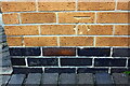
Benchmark on #1 Deering Court
Ordnance Survey cut mark benchmark described on the Bench Mark Database at www.bench-marks.org.uk/bm114991
Image: © Luke Shaw
Taken: 11 May 2019
0.07 miles
6
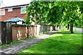
Looking NE along the NW side of Queen's Walk
There is an Ordnance Survey benchmark Image on the wall pier near the left hand edge of the image
Image: © Luke Shaw
Taken: 11 May 2019
0.07 miles
7
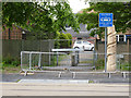
Pedestrian crossing and story pole 9: Old Meadows
The crossing is not yet in use, but the new signs are in position.
The story pole is the first of twelve to be erected along Queens Walk, carved from the lime trees felled to make way for the tramway.
Image: © Alan Murray-Rust
Taken: 14 May 2014
0.07 miles
8
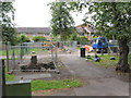
Crossing point, Queen's Walk
A number of pedestrian crossing points across the tram works have had to be maintained.
Image: © Alan Murray-Rust
Taken: 23 Aug 2012
0.07 miles
9
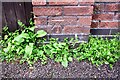
Benchmark on wall junction on NW side of Queen's Walk
Ordnance Survey cut mark benchmark described on the Bench Mark Database at www.bench-marks.org.uk/bm112062
Image: © Luke Shaw
Taken: 11 May 2019
0.07 miles
10
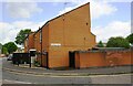
Houses of Deering Court from Robin Hood Way
There is an Ordnance Survey benchmark Image on the left hand corner of the nearest house
Image: © Luke Shaw
Taken: 11 May 2019
0.07 miles