IMAGES TAKEN NEAR TO
Southwell Road East, MANSFIELD, NG21 0BW
Introduction
This page details the photographs taken nearby to Southwell Road East, NG21 0BW by members of the Geograph project.
The Geograph project started in 2005 with the aim of publishing, organising and preserving representative images for every square kilometre of Great Britain, Ireland and the Isle of Man.

There are currently over 7.5m images from over14,400 individuals and you can help contribute to the project by visiting https://www.geograph.org.uk
Image Map
Images are licensed for reuse under creativecommons.org/licenses/by-sa/2.0
Notes
- Clicking on the map will re-center to the selected point.
- The higher the marker number, the further away the image location is from the centre of the postcode.
Image Listing (15 Images Found)
Images are licensed for reuse under creativecommons.org/licenses/by-sa/2.0
Image
Details
Distance
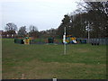
2
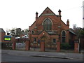
Pumping station entrance, Rainworth
The pumping station opened in 1895.
Image: © Jonathan Thacker
Taken: 12 Jan 2020
0.07 miles
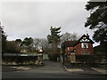
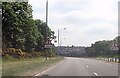
3
Southwell Road East (B6020), Rainworth
Heading east.
Image: © JThomas
Taken: 17 Mar 2014
0.07 miles
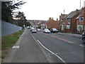
4
Southwell Road East, Toward Mansfield
Looking west toward Mansfield on a cold December day
Image: © Robert Meehan
Taken: 22 Dec 2006
0.09 miles
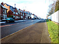
6
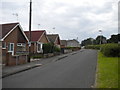
Southwell Road East, Rainworth (2)
Actually a service road running parallel to the main road as it heads out of the village towards Mansfield.
Image: © Richard Vince
Taken: 14 Jun 2014
0.16 miles
7
Boundary stone at Rainworth
This stone marks the boundary between Mansfield and Rainworth Civil Parish. It is marked on the 1:25000 Explorer map.
Image: © Antony Dixon
Taken: 16 Nov 2011
0.17 miles
8
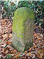
Boundary stone at Rainworth (close-up)
This is a close-up of the stone shown here http://www.geograph.org.uk/photo/2696170. You can just see the letter M carved into the stone.
Image: © Antony Dixon
Taken: 16 Nov 2011
0.17 miles
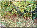
9
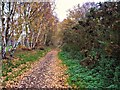
Former railway line at Rainworth
Looking east along the course of the railway line that skirted the northern edge of Rainworth. It was a mineral line and did not carry passengers.
Image: © Antony Dixon
Taken: 16 Nov 2011
0.18 miles
10
Bend on A617
Just south east of Rainworth Nurseries
Image: © John Firth
Taken: 9 Jun 2013
0.18 miles