IMAGES TAKEN NEAR TO
Laurel Close, MANSFIELD, NG20 8HX
Introduction
This page details the photographs taken nearby to Laurel Close, NG20 8HX by members of the Geograph project.
The Geograph project started in 2005 with the aim of publishing, organising and preserving representative images for every square kilometre of Great Britain, Ireland and the Isle of Man.

There are currently over 7.5m images from over14,400 individuals and you can help contribute to the project by visiting https://www.geograph.org.uk
Image Map (Loading...)


Getting Data...Please wait
Leaflet Map data © OpenStreetMap
Images are licensed for reuse under creativecommons.org/licenses/by-sa/2.0
Notes
- Clicking on the map will re-center to the selected point.
- The higher the marker number, the further away the image location is from the centre of the postcode.
Image Listing (10 Images Found)
Images are licensed for reuse under creativecommons.org/licenses/by-sa/2.0
Image
Details
Distance
1
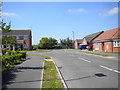
West end of Albine Road, Langwith Junction
With the north end of Pear Tree Drive visible on the left.
Image: © Richard Vince
Taken: 5 May 2018
0.09 miles
2
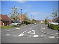
Highfield Avenue, Langwith Junction
Seen from Albine Road.
Image: © Richard Vince
Taken: 5 May 2018
0.10 miles
3
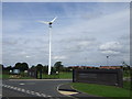
Wind turbine near entrance to Shirebrook Academy
Image: © JThomas
Taken: 28 Aug 2014
0.17 miles
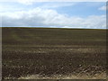
5
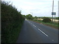
Common Lane
Heading north towards Upper Langwith.
Image: © JThomas
Taken: 28 Aug 2014
0.22 miles
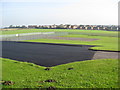
6
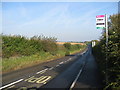
Common Lane - View from Shirebrook School
Image: © Alan Heardman
Taken: 12 Oct 2008
0.22 miles
7
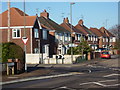
Houses in Langwith Junction
Looking from the northern end of Recreation Road.
Image: © Andrew Hill
Taken: 8 Jan 2011
0.23 miles
8
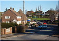
Looking along Recreation Road, Langwith Junction
The residential street curves and rises gently.
Image: © Andrew Hill
Taken: 8 Jan 2011
0.24 miles
10
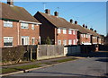
Houses on Recreation Road, Shirebrook
Traditional semis on this long residential street.
Image: © Andrew Hill
Taken: 8 Jan 2011
0.24 miles