IMAGES TAKEN NEAR TO
Carnation Road, MANSFIELD, NG20 8FG
Introduction
This page details the photographs taken nearby to Carnation Road, NG20 8FG by members of the Geograph project.
The Geograph project started in 2005 with the aim of publishing, organising and preserving representative images for every square kilometre of Great Britain, Ireland and the Isle of Man.

There are currently over 7.5m images from over14,400 individuals and you can help contribute to the project by visiting https://www.geograph.org.uk
Image Map
Images are licensed for reuse under creativecommons.org/licenses/by-sa/2.0
Notes
- Clicking on the map will re-center to the selected point.
- The higher the marker number, the further away the image location is from the centre of the postcode.
Image Listing (10 Images Found)
Images are licensed for reuse under creativecommons.org/licenses/by-sa/2.0
Image
Details
Distance
3
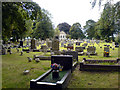
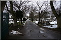
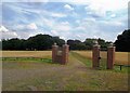
Shirebrook Cemetery
The cemetery at Shirebrook.
Image: © James Hill
Taken: 9 Sep 2007
0.12 miles
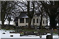
6
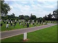
Shirebrook Cemetery
Situated in a suitably peaceful spot overlooking the town.
Image: © Jonathan Clitheroe
Taken: 26 Jul 2014
0.19 miles
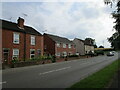
7
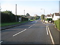
Shirebrook - Main Street (Junction with Little Lane)
Image: © Alan Heardman
Taken: 12 Oct 2008
0.21 miles
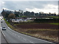
8
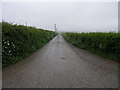
Road to Roseland
This farm road leads to Roseland Farm. The farm itself is located in the next square west.
Image: © Michael Patterson
Taken: 26 May 2006
0.22 miles
10
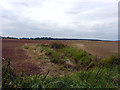
Spring or Pond
This is what appears to be a pond or a spring next to Common Lane in Shirebrook.
Image: © James Hill
Taken: 9 Sep 2007
0.25 miles