IMAGES TAKEN NEAR TO
Weetman Avenue, MANSFIELD, NG20 0SB
Introduction
This page details the photographs taken nearby to Weetman Avenue, NG20 0SB by members of the Geograph project.
The Geograph project started in 2005 with the aim of publishing, organising and preserving representative images for every square kilometre of Great Britain, Ireland and the Isle of Man.

There are currently over 7.5m images from over14,400 individuals and you can help contribute to the project by visiting https://www.geograph.org.uk
Image Map
Images are licensed for reuse under creativecommons.org/licenses/by-sa/2.0
Notes
- Clicking on the map will re-center to the selected point.
- The higher the marker number, the further away the image location is from the centre of the postcode.
Image Listing (73 Images Found)
Images are licensed for reuse under creativecommons.org/licenses/by-sa/2.0
Image
Details
Distance
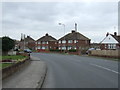
2
Netherfield Lane, Church Warsop
Looking towards Meden Vale from Coggins Lane.
Image: © Richard Vince
Taken: 25 Jun 2022
0.07 miles
3
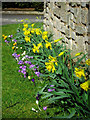
Spring flowers in Church Warsop
Crocuses, daffodils, snowdrops and even a few tulips are making an springtime impression in the area now.
Image: © Andy Stephenson
Taken: 1 Mar 2015
0.10 miles
4
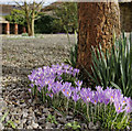
Spring on the way
Crocus season is in full swing as we near the end of February. An exceptionally mild (although wet) winter is showing signs of giving way to what we hope will be a dry spring.
Image: © Andy Stephenson
Taken: 22 Feb 2014
0.10 miles
5
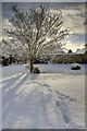
Warsop's first snow of the 2010 winter
Snow was a surprise November visitor, but with local temperatures down to minus 13C overnight, it doesn't look like it's about to leave in a hurry!
Image: © Andy Stephenson
Taken: 27 Nov 2010
0.10 miles
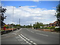
6
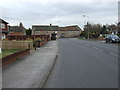
In Church Warsop
View from the end of Manor Road to Eastlands Lane (ahead) and Coggins Lane (right).
Image: © Andrew Hill
Taken: 15 May 2014
0.11 miles
8
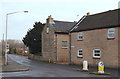
Manor Road, Church Warsop, Notts.
Coggins Lane on the left, is seen here joining Manor Lane.
Image: © David Hallam-Jones
Taken: 23 Jan 2016
0.11 miles
9
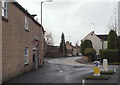
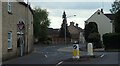
Junction, Church Warsop, Notts.
Once past the "Give Way" sign here, at the western end of Manor Lane, users initially enter the southern end of Coggins Lane (on the right) before feeding into Eastlands Lane (ahead). The A60 (a.k.a. Church Road) lies 500 metres ahead.
Image: © David Hallam-Jones
Taken: 23 Jan 2016
0.11 miles
10
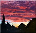
Unusual sunset, Eastlands Lane
The sun illuminates an unusual cloud formation - this lasted for a couple of minutes before suddenly fading.
Image: © Andy Stephenson
Taken: 27 Oct 2016
0.11 miles