1
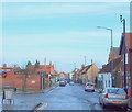
Terraced housing on Vickers Street
Image: © Graham Hogg
Taken: 31 May 2016
0.09 miles
2
Sherwood Street, Market Warsop, Notts.
The Hub Business Centre appears to have been established in two former houses. The car appears to have come from the town centre direction, less than a minute away.
Image: © David Hallam-Jones
Taken: 23 Jan 2016
0.11 miles
3
Clumber Street, Market Warsop, Notts.
The town's Methodist Church occupies a corner site formed by Portland Street (where the car is parked) and Portland Street that can be seen linking up with Sherwood Street (the B6035) ahead. Clumber Street was formerly known as Back Street.
Image: © David Hallam-Jones
Taken: 23 Jan 2016
0.13 miles
4
Pre-industrial Market Warsop
Market Warsop is largely a twentieth century creation though there are a few buildings from an earlier era. Most, like this cottage, have been substantially altered and are often in poor condition.
Image: © Jonathan Thacker
Taken: 21 Sep 2018
0.13 miles
5
Clumber Street, Market Warsop, Notts.
With the B6035 (a.k.a. Sherwood Street) ten paces behind the photographer, this is a view of the town's Methodist Church on one side of the town centre end of Clumber Street. Clumber Street was formerly known as Back Street.
Image: © David Hallam-Jones
Taken: 23 Jan 2016
0.14 miles
6
Longden Terrace, Market Warsop
Image: © Neil Theasby
Taken: 11 Aug 2020
0.14 miles
7
High Street, Market Warsop, Notts.
A view from the cul-de-sac end of High Street. The site occupied by Grandma's Bakery, parallel with the second parked car on the right, is a 200 square metre plot identified by the local Council in January 2016 the site for a new housing development.
Image: © David Hallam-Jones
Taken: 23 Jan 2016
0.15 miles
8
Floral display, High Street, Warsop
Floral display at the top of High Street. Also shows the A60 road through Warsop and the Black Market Bar & Live Music Venue/Warsop Workingmens Club.
Image: © Ann B
Taken: 27 Aug 2006
0.15 miles
9
St Teresa?s Catholic Church, Market Warsop
Built in 1974. Read more at; http://www.saint-joseph.org.uk/st-teresas/
Image: © Chris Morgan
Taken: 31 May 2016
0.15 miles
10
High Street, Market Warsop, Notts.
In January 2016 the local Council identified a piece of land of 200 square metres on the right hand side of The Crate and Grape pub (behind Grandma's Bakery) as a potential housing development site.
Image: © David Hallam-Jones
Taken: 23 Jan 2016
0.16 miles


