IMAGES TAKEN NEAR TO
Newhaven Avenue, MANSFIELD, NG19 9LL
Introduction
This page details the photographs taken nearby to Newhaven Avenue, NG19 9LL by members of the Geograph project.
The Geograph project started in 2005 with the aim of publishing, organising and preserving representative images for every square kilometre of Great Britain, Ireland and the Isle of Man.

There are currently over 7.5m images from over14,400 individuals and you can help contribute to the project by visiting https://www.geograph.org.uk
Image Map
Images are licensed for reuse under creativecommons.org/licenses/by-sa/2.0
Notes
- Clicking on the map will re-center to the selected point.
- The higher the marker number, the further away the image location is from the centre of the postcode.
Image Listing (65 Images Found)
Images are licensed for reuse under creativecommons.org/licenses/by-sa/2.0
Image
Details
Distance
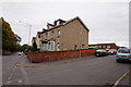
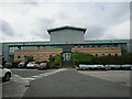
2
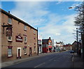
Snooker Hall on Sherwood Street, Mansfield Woodhouse
At the junction with Debden Lane.
Image: © Peter Barr
Taken: 16 Aug 2013
0.06 miles
4
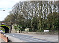
Mansfield Woodhouse NG19, Notts.
The railway bridge that carries The Robin Hood Line over the A6075. Any traffic seen crossing the bridge and travelling towards the left would have just left the station and be heading towards Mansfield, the next station down the line. The road on this side of the bridge is Priory Road, whereas on the other side of the bridge the A6075 is known as Debdale Lane. The road off to the right is Station Hill.
Image: © David Hallam-Jones
Taken: 28 Apr 2013
0.09 miles
5
Signal Way, Mansfield Woodhouse
Providing vehicular access to some industrial premises, and pedestrian access to Mansfield Woodhouse railway station.
Image: © Richard Vince
Taken: 5 May 2018
0.10 miles
6
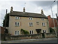
82/84 Station Street, Mansfield Woodhouse
Eighteenth century house refronted in the nineteenth century https://historicengland.org.uk/listing/the-list/list-entry/1262548
Image: © Jonathan Thacker
Taken: 9 Sep 2021
0.12 miles
7
Mansfield Woodhouse NG19, Notts.
Looking along Station Street in the direction of High Street. The railway station sits two minutes away behind the photographer.
Image: © David Hallam-Jones
Taken: 28 Apr 2013
0.13 miles
8
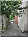
Path between Grove Street and Station Street, Mansfield Woodhouse
Looking towards Station Street.
Image: © Jonathan Thacker
Taken: 9 Sep 2021
0.14 miles
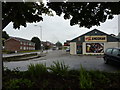
9
B and J Parr, Manfield Woodhouse
Plastic recycling plant https://bjparr.co.uk/
Image: © Jonathan Thacker
Taken: 9 Sep 2021
0.14 miles
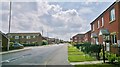
10
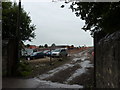
New housing estate being built
On Debdale Lane, Mansfield Woodhouse.
Image: © Peter Barr
Taken: 16 Aug 2013
0.15 miles