IMAGES TAKEN NEAR TO
Northfield Avenue, MANSFIELD, NG19 8SG
Introduction
This page details the photographs taken nearby to Northfield Avenue, NG19 8SG by members of the Geograph project.
The Geograph project started in 2005 with the aim of publishing, organising and preserving representative images for every square kilometre of Great Britain, Ireland and the Isle of Man.

There are currently over 7.5m images from over14,400 individuals and you can help contribute to the project by visiting https://www.geograph.org.uk
Image Map
Images are licensed for reuse under creativecommons.org/licenses/by-sa/2.0
Notes
- Clicking on the map will re-center to the selected point.
- The higher the marker number, the further away the image location is from the centre of the postcode.
Image Listing (15 Images Found)
Images are licensed for reuse under creativecommons.org/licenses/by-sa/2.0
Image
Details
Distance
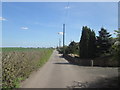
2
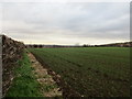
View towards Northfield Avenue
The restored former slag heap of Sherwood Colliery dominates in the distance.
Image: © Jonathan Thacker
Taken: 28 Nov 2017
0.09 miles
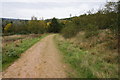
3
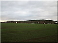
Mansfield Woodhouse Area NG19, Notts.
The smaller of two lakes in this part of the parkland forming part of the Oxclose Wood site. A vast area of land, that included the former Sherwood Colliery spoil tip(s) has been developed in an unstaffed country park, albeit not designated as such. The elevated footpath on the right connects the section of Oxclose Lane nearest to the village of Mansfield Woodhouse with the Northfield Lane side of park, i.e. in the past the tip(s) expanded upwards and outwards and a series of footpaths have now been constructed to encircle and surmount the landscaped tips.
Image: © David Hallam-Jones
Taken: 28 Apr 2013
0.10 miles
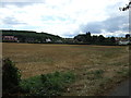
4
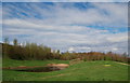
Mansfield Woodhouse Area NG19, Notts.
The edges of two lakes are seen here in part of the Oxclose Wood site, an unstaffed country park in all but name. This vast area of reclaimed land includes the former Sherwood Colliery spoil tip(s). Walkers can reach Pleasley Vale and Pleasley village beyond the distant "hill" by following one of the Mansfield Woodhouse Heritage Trails. Mansfield Woodhouse lies several miles walk away behind the photographer.
Image: © David Hallam-Jones
Taken: 28 Apr 2013
0.10 miles
9
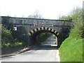
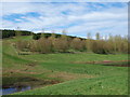
Railway bridge over Common Lane, Mansfield Woodhouse
Image: © John Slater
Taken: 4 May 2016
0.19 miles
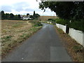
10
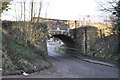
Stone Railway Bridge
Taking the Robin Hood line into Mansfield Woodhouse. Common lane passes underneath.
Image: © Ashley Dace
Taken: 24 Feb 2011
0.19 miles