Mansfield Woodhouse Area NG19, Notts.
Introduction
The photograph on this page of Mansfield Woodhouse Area NG19, Notts. by David Hallam-Jones as part of the Geograph project.
The Geograph project started in 2005 with the aim of publishing, organising and preserving representative images for every square kilometre of Great Britain, Ireland and the Isle of Man.

There are currently over 7.5m images from over 14,400 individuals and you can help contribute to the project by visiting https://www.geograph.org.uk
Mansfield Woodhouse Area NG19, Notts.
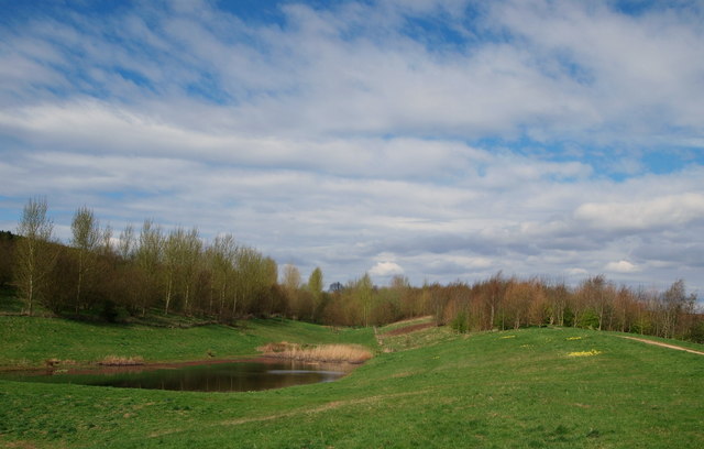
Image: © David Hallam-Jones Taken: 28 Apr 2013
The smaller of two lakes in this part of the parkland forming part of the Oxclose Wood site. A vast area of land, that included the former Sherwood Colliery spoil tip(s) has been developed in an unstaffed country park, albeit not designated as such. The elevated footpath on the right connects the section of Oxclose Lane nearest to the village of Mansfield Woodhouse with the Northfield Lane side of park, i.e. in the past the tip(s) expanded upwards and outwards and a series of footpaths have now been constructed to encircle and surmount the landscaped tips.
Images are licensed for reuse under creativecommons.org/licenses/by-sa/2.0
Image Location
Latitude
53.1667
Longitude
-1.207475