IMAGES TAKEN NEAR TO
Lancelot Way, MANSFIELD, NG19 6FJ
Introduction
This page details the photographs taken nearby to Lancelot Way, NG19 6FJ by members of the Geograph project.
The Geograph project started in 2005 with the aim of publishing, organising and preserving representative images for every square kilometre of Great Britain, Ireland and the Isle of Man.

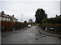
There are currently over 7.5m images from over14,400 individuals and you can help contribute to the project by visiting https://www.geograph.org.uk
Image Map
Images are licensed for reuse under creativecommons.org/licenses/by-sa/2.0
Notes
- Clicking on the map will re-center to the selected point.
- The higher the marker number, the further away the image location is from the centre of the postcode.
Image Listing (16 Images Found)
Images are licensed for reuse under creativecommons.org/licenses/by-sa/2.0
Image
Details
Distance
1
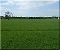
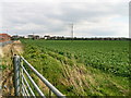
Crop field, Penniment Farm
West of the A6075.
Image: © JThomas
Taken: 18 Apr 2014
0.05 miles
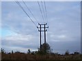
2
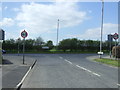
Junction of Westfield Lane with Abbott Road (A6075)
Looking west.
Image: © JThomas
Taken: 18 Apr 2014
0.05 miles

4
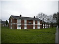
Low rise flats off Abbott Road, Mansfield
Image: © Richard Vince
Taken: 12 Dec 2020
0.11 miles
5
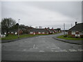
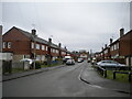
Collingham Road, Mansfield
Leading to a bevy of bungalows off Westfield Lane.
Image: © Richard Vince
Taken: 12 Dec 2020
0.12 miles
6
Farmland on Water Lane, Mansfield
Farmland on Water Lane, Mansfield, Nottinghamshire. Modern Housing developments encroach with older housing on the horizon.
Image: © Keith Havercroft
Taken: 16 Apr 2006
0.13 miles
8
Mellors Road, Mansfield
Looking from Wainwright Avenue towards Westfield Lane.
Image: © Richard Vince
Taken: 12 Dec 2020
0.15 miles
9
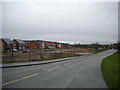
New housing south of Water Lane, Bull Farm
Many of the houses on this development appear to be occupied, even though the infrastructure is still under construction. Like a lot of housing developments of recent years, this one seems to have been designed to be as separate as possible from the existing housing in the area.
Image: © Richard Vince
Taken: 12 Dec 2020
0.15 miles
10
South east end of Wainwright Avenue, Mansfield
Sort of forming a cul de sac off itself, leading to a playing field.
Image: © Richard Vince
Taken: 12 Dec 2020
0.16 miles