1
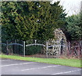
Edgar Avenue
Heading east off Woodhouse Road.
Image: © JThomas
Taken: 16 Mar 2014
0.05 miles
2
Robin Hood Line, Mansfield
The Robin Hood Line as it passes beneath the bridge next to Carr Bank Park in Mansfield.
Image: © James Hill
Taken: 2 Jul 2007
0.11 miles
3
Clipstone Lane
Image: © Bob Harvey
Taken: 10 Mar 2016
0.11 miles
4
Windmill Lane
On the left is the roof of
Image
Image: © Bob Harvey
Taken: 10 Mar 2016
0.12 miles
5
Windmill Lane
Image: © Bob Harvey
Taken: 10 Mar 2016
0.12 miles
6
The Coachhouse
A late 19th century addition to Carr Bank this stands behind
Image but is not part of the listed building status. Run separately from the hotel it provides a meeting room and a cafe for users of the park.
Image: © Bob Harvey
Taken: 10 Mar 2016
0.13 miles
7
Windmill Lane, Mansfield, Notts.
The former Carr Bank House stables, c.1805. The main house (now The Mansfield Manor Hotel), was once the family home of a local cotton industrialist, a Mr Stanton. Since the main house was previously used as office space for local Council staff, perhaps the converted stables were too? Now however, there is a café situated on the first floor and two shops on the ground floor. The main house, behind this block, overlooks Carr Bank Park.
Image: © David Hallam-Jones
Taken: 8 Jan 2015
0.13 miles
8
Windmill Lane, Mansfield, Notts.
The former Carr Bank House stables, c.1805. A corner of the main house (now The Mansfield Manor Hotel) - once the family home of a local cotton industrialist, Mr Stanton - is visible on the left. Since the main house was previously used as office space for local Council staff perhaps the converted stables were too? Now however, there is a café situated on the first floor and two shops on the ground floor. Windmill Lane is situated behind this block running parallel with the former stables. The main house overlooks the park.
Image: © David Hallam-Jones
Taken: 8 Jan 2015
0.14 miles
9
Stone built building, Carr Bank Park
A stone built building within Mansfield's Carr Bank Park. I'm not sure what its purpose is or was but it does look enticing as it peeks out from around the bushes.
Image: © James Hill
Taken: 2 Jul 2007
0.14 miles
10
Grotto, Carr Bank Park, Mansfield, Notts.
Beyond the eastern boundary fence of this car park (off Windmill Lane), shared by The Mansfield Manor Hotel and Carr Bank Park, is this Grade II-listed early-C19th garden grotto that was restored in the late C20th. It is of limestone rubble stabilised with cement and partly covered with earth. It is in the form of a curved tunnel with this conical shaped entrance on its west side. Its east entrance/exit, situated in the formal rose garden (now part of the park), takes the form of a segmental arch. The structure is thought to have been built as part of the house's gardens that were created on three sides of it, excluding of course the side occupied by the converted stable block parallel with Windmill Lane.
Image: © David Hallam-Jones
Taken: 8 Jan 2015
0.14 miles


