
IMAGES TAKEN NEAR TO
Hazel Street, SUTTON-IN-ASHFIELD, NG17 3FJ
Introduction
This page details the photographs taken nearby to Hazel Street, NG17 3FJ by members of the Geograph project.
The Geograph project started in 2005 with the aim of publishing, organising and preserving representative images for every square kilometre of Great Britain, Ireland and the Isle of Man.

There are currently over 7.5m images from over14,400 individuals and you can help contribute to the project by visiting https://www.geograph.org.uk
Image Map
Images are licensed for reuse under creativecommons.org/licenses/by-sa/2.0
Notes
- Clicking on the map will re-center to the selected point.
- The higher the marker number, the further away the image location is from the centre of the postcode.
Image Listing (19 Images Found)
Images are licensed for reuse under creativecommons.org/licenses/by-sa/2.0
Image
Details
Distance
2
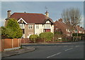
Corner of Elder Street and Hazel Street, Skegby
A well established housing estate north of the B6014.
Image: © Andrew Hill
Taken: 1 Dec 2011
0.08 miles
3
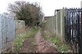
Public footpath
This southerly facing photograph is of a somewhat litter-strewn public footpath running between Skegby (ahead) and Teversal (behind the viewpoint). The photograph was taken from near the footpaths junction with Ash Grove, Skegby.
For a photograph of the footpath taken some 70m ahead, click here:- Image
Some 165m behind the viewpoint is an Image
Image: © Alan Walker
Taken: 18 Feb 2018
0.10 miles
4
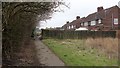
Public footpath
This southerly facing photograph is of a public footpath running between Teversal and Skegby. The photograph was taken from a section of the path that runs from Ash Grove (behind the viewpoint) to Image (ahead), both of which are in Skegby https://en.wikipedia.org/wiki/Skegby .
For a photograph of the footpath taken some 70m behind the footpath, click here:- Image
Image: © Alan Walker
Taken: 18 Feb 2018
0.11 miles
5
Elder Street
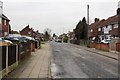
The photograph shows Elder Street in Skegby. At the viewpoint a public footpath from Teversal to Skegby https://en.wikipedia.org/wiki/Skegby crosses the street right to left.
For a photograph of the footpath taken some 75m to the south (left of the viewpoint), click here:- Image
For a photograph of the footpath taken some 125m to the north (right of the viewpoint) in a section that runs from Ash Grove to Elder Street, click here:- Image
See also this photograph by Andrew Hill :- Image
Image: © Alan Walker
Taken: 18 Feb 2018
0.13 miles
6
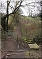
Access to a public footpath
This southerly facing photograph is of the access to a public footpath running between Skegby (ahead) and Teversal (behind the viewpoint). The photograph was taken from an Image on the Link Trail.
Some 165m ahead the Image approaches the outskirts of Skegby.
- - -
The Link Trail was built on the track bed of the former Great Northern Railway's Teversal branch line, which gave the company access to the collieries at Silverhill and Teversal.
This trail is one of three, namely the Link Trail, the Skegby Trail and the Teversal Trail which are collectively referred to as the Teversal Trails. These trails are included in the Ashfield Trails Network http://www.nottinghamshire.gov.uk/planning-and-environment/countryside-and-green-spaces/green-spaces/teversal-trails and the Phoenix Greenways network https://derbyshire.gov.uk/images/Phoenix%20Greenways%202015%20web_tcm44-159660.pdf .
Image: © Alan Walker
Taken: 18 Feb 2018
0.14 miles
7
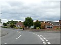
Bungalows on Manor Road
At its junction with Greenland Road.
Image: © Graham Hogg
Taken: 12 Jun 2017
0.14 miles
8
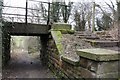
Underbridge on the Link Trail
This northerly facing photograph is of the western of the middle two of four such structures on the Link Trail. The westernmost is here, some 230m west of the viewpoint:- Image
Unlike the other three underbridges, this one provides Image that runs between Teversal (ahead and through part of the Teversal Pastures Nature Reserve http://www.nottinghamshirewildlife.org/nature-reserves/teversal-pastures-sssi/ ) and Skegby (behind the viewpoint).
See also this photograph of the underbridge taken from above:- Image
Some 165m behind the viewpoint the Image approaches the outskirts of Skegby.
- - -
The underbridges (east to west) on the link trail are:-
Image,
Image,
This photograph, and
Image
- - -
The Link Trail was built on the track bed of the former Great Northern Railway's Teversal branch line, which gave the company access to the collieries at Silverhill and Teversal.
This trail is one of three, namely the Link Trail, the Skegby Trail and the Teversal Trail which are collectively referred to as the Teversal Trails. These trails are included in the Ashfield Trails Network http://www.nottinghamshire.gov.uk/planning-and-environment/countryside-and-green-spaces/green-spaces/teversal-trails and the Phoenix Greenways network https://derbyshire.gov.uk/images/Phoenix%20Greenways%202015%20web_tcm44-159660.pdf .
The western end of Image is some 440m ahead.
The eastern end of Image is some 950m behind the viewpoint.
Image: © Alan Walker
Taken: 18 Feb 2018
0.15 miles
9
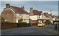
Hazel Street, Skegby
A residential street north of the B6014.
Image: © Andrew Hill
Taken: 1 Dec 2011
0.15 miles
10
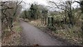
Underbridge on the Link Trail
This easterly facing photograph is of the western of the middle two of four such structures on the Link Trail. The westernmost is here, some 230m behind the viewpoint:- Image
Unlike the other three underbridges, this one provides Image running between Teversal to the north and Skegby to the south.
See also this photograph of the underbridge taken from below:- Image
Some 130m behind the viewpoint Image flows through a culvert under the trail.
- - -
The underbridges (east to west) on the link trail are:-
Image,
Image,
This photograph, and
Image
- - -
The Link Trail was built on the track bed of the former Great Northern Railway's Teversal branch line, which gave the company access to the collieries at Silverhill and Teversal.
This trail is one of three, namely the Link Trail, the Skegby Trail and the Teversal Trail which are collectively referred to as the Teversal Trails. These trails are included in the Ashfield Trails Network http://www.nottinghamshire.gov.uk/planning-and-environment/countryside-and-green-spaces/green-spaces/teversal-trails and the Phoenix Greenways network https://derbyshire.gov.uk/images/Phoenix%20Greenways%202015%20web_tcm44-159660.pdf .
The western end of Image is some 440m ahead.
The eastern end of Image is some 950m behind the viewpoint.
Image: © Alan Walker
Taken: 18 Feb 2018
0.16 miles