Access to a public footpath
Introduction
The photograph on this page of Access to a public footpath by Alan Walker as part of the Geograph project.
The Geograph project started in 2005 with the aim of publishing, organising and preserving representative images for every square kilometre of Great Britain, Ireland and the Isle of Man.

There are currently over 7.5m images from over 14,400 individuals and you can help contribute to the project by visiting https://www.geograph.org.uk
Access to a public footpath
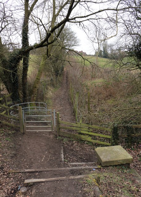
Image: © Alan Walker Taken: 18 Feb 2018
This southerly facing photograph is of the access to a public footpath running between Skegby (ahead) and Teversal (behind the viewpoint). The photograph was taken from an Image on the Link Trail. Some 165m ahead the Image approaches the outskirts of Skegby. - - - The Link Trail was built on the track bed of the former Great Northern Railway's Teversal branch line, which gave the company access to the collieries at Silverhill and Teversal. This trail is one of three, namely the Link Trail, the Skegby Trail and the Teversal Trail which are collectively referred to as the Teversal Trails. These trails are included in the Ashfield Trails Network http://www.nottinghamshire.gov.uk/planning-and-environment/countryside-and-green-spaces/green-spaces/teversal-trails and the Phoenix Greenways network https://derbyshire.gov.uk/images/Phoenix%20Greenways%202015%20web_tcm44-159660.pdf .
Images are licensed for reuse under creativecommons.org/licenses/by-sa/2.0
Image Location
Latitude
53.148495
Longitude
-1.270459