1
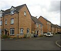
Mercia Court, Huthwaite
A residential cul de sac off Cross Lane.
Image: © Richard Vince
Taken: 12 Dec 2020
0.04 miles
2
East end of Cross Lane, Huthwaite
At this point, it becomes a restricted byway.
Image: © Richard Vince
Taken: 12 Dec 2020
0.04 miles
3
Track by Greenwood Falls Farm
Image: © Chris Morgan
Taken: 26 Jul 2021
0.05 miles
4
East end of Greenwood Avenue, Huthwaite
Off Columbia Street.
Image: © Richard Vince
Taken: 12 Dec 2020
0.07 miles
5
Windmill Way, Huthwaite
New housing in a development known as Brierley Hills.
Image: © Neil Theasby
Taken: 20 Apr 2021
0.12 miles
6
South end of Greenwood Avenue, Huthwaite
Off Cross Lane.
Image: © Richard Vince
Taken: 12 Dec 2020
0.14 miles
7
Huthwaite, Sutton-in-Ashfield NG17, Notts.
The start (or end) of Mill Lane, an unsurfaced track descending from the B6026 road can be seen here on the left. On its way uphill (or downhill) it passes between the rear entrances of Huthwaite cemetery and "The Welfare (recreation) Ground". A row of half a dozen or so terraced houses known as "Colliery Cottages", associated with the former New Hucknall Colliery that existed until 1982, are situated behind the photographer's left shoulder. The Mill House Gardens housing development on the left (although not visible here) was completed some time ago (? date) and now the "Brierley Hills" housing development can be seen evolving on the right. Brierley Hill, Staffordshire is where some of the first miners in Huthwaite came from during the early 1870s.
Image: © David Hallam-Jones
Taken: 2 Mar 2013
0.16 miles
8
Modern housing in Huthwaite
Image: © Graham Hogg
Taken: 26 Jul 2021
0.16 miles
9
Cemetery, Sutton-in-Ashfield
Image: © Chris Morgan
Taken: 26 Jul 2021
0.17 miles
10
Huthwaite, Sutton-in-Ashfield NG17, Notts
"The Huthwaite (miners') Welfare (recreation) Ground" is sandwiched between Columbia Street and Mill Lane, an unsurfaced track from where this picture was taken. Both of these plummet downhill from the main road that passes through Huthwaite i.e. the B6026. This land was donated for community use by the New Hucknall Colliery Company and the original access to it when it first opened in 1920 was via a set of gates off Columbia Street. The newer 'main entrance', off the B6026, was created later. A path, beneath this one, connected these two thoroughfares and was regularly walked by coal miners going to and from the New Hucknall Colliery.
a miners welfare sports ground, pavilion and recreation ground in Columbia Street, Sutton Road.
Image: © David Hallam-Jones
Taken: 2 Mar 2013
0.19 miles


