IMAGES TAKEN NEAR TO
Nottingham Road, NOTTINGHAM, NG16 4HG
Introduction
This page details the photographs taken nearby to Nottingham Road, NG16 4HG by members of the Geograph project.
The Geograph project started in 2005 with the aim of publishing, organising and preserving representative images for every square kilometre of Great Britain, Ireland and the Isle of Man.

There are currently over 7.5m images from over14,400 individuals and you can help contribute to the project by visiting https://www.geograph.org.uk
Image Map
Images are licensed for reuse under creativecommons.org/licenses/by-sa/2.0
Notes
- Clicking on the map will re-center to the selected point.
- The higher the marker number, the further away the image location is from the centre of the postcode.
Image Listing (29 Images Found)
Images are licensed for reuse under creativecommons.org/licenses/by-sa/2.0
Image
Details
Distance
1
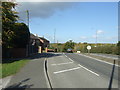
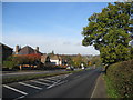
Nottingham Road (A610)
Heading north west towards Codnor.
A dual carriageway at this point.
Image: © JThomas
Taken: 20 Oct 2015
0.02 miles
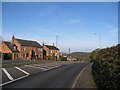
4
Nottingham Road at Woodlinkin
Originally a country lane linking Codnor with Aldercar, it was rebuilt as a dual carriageway during the late 1930s as unemployment relief as part of a scheme to bypass Langley Mill and Heanor. The full potential was not realised until the completion of the Langley Mill and Eastwood and Kimberley bypasses in the 1970s and 80s. This section is a fine example of 1930s ribbon development, entirely dependent of the use of the still relatively uncommon motor car - there has never been a bus service along here.
Image: © Alan Murray-Rust
Taken: 19 May 2010
0.05 miles
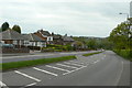
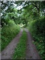
5
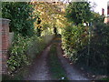
Track (footpath) off Nottingham Road (A610)
Footpath heads west to Cross Hill.
Image: © JThomas
Taken: 20 Oct 2015
0.06 miles
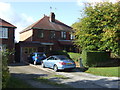
6
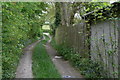
Farm track at Woodlinkin
this doubles as public footpath.
Image: © Alan Murray-Rust
Taken: 19 May 2010
0.06 miles
7
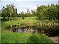
Pond, Ormonde Fields golf course
One of the natural hazards on this 18 hole, undulating parkland course. There were several coots on the pond.
Image: © Lynne Kirton
Taken: 24 Jun 2006
0.10 miles
9
Track, Woodlinkin
This track runs between Woodlinkin & Loscoe, and at this point it is beside Ormonde Fields golf course (left of picture).
Image: © Lynne Kirton
Taken: 24 Jun 2006
0.12 miles
10
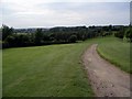
View over Ormonde Fields golf course
This 18 hole course was first opened in 1906. The black dot in the sky in the distance is one of five hot air balloons which were aloft on this still summer evening.
Image: © Lynne Kirton
Taken: 24 Jun 2006
0.14 miles