IMAGES TAKEN NEAR TO
Newthorpe, NOTTINGHAM, NG16 3QY
Introduction
This page details the photographs taken nearby to NG16 3QY by members of the Geograph project.
The Geograph project started in 2005 with the aim of publishing, organising and preserving representative images for every square kilometre of Great Britain, Ireland and the Isle of Man.

There are currently over 7.5m images from over14,400 individuals and you can help contribute to the project by visiting https://www.geograph.org.uk
Image Map
Images are licensed for reuse under creativecommons.org/licenses/by-sa/2.0
Notes
- Clicking on the map will re-center to the selected point.
- The higher the marker number, the further away the image location is from the centre of the postcode.
Image Listing (17 Images Found)
Images are licensed for reuse under creativecommons.org/licenses/by-sa/2.0
Image
Details
Distance
1
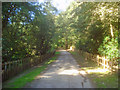
Entrance to Beauvale House
Private road heading north-east through High Park Wood. The public bridleway bears left just ahead.
Image: © Trevor Rickard
Taken: 10 Sep 2009
0.09 miles
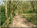
3
Public Bridleway through High Park Wood
Heading south through an understorey of rhododendrons.
Image: © Trevor Rickard
Taken: 10 Sep 2009
0.11 miles
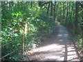
4
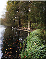
Bridleway in High Park Wood
This path follows the bank of Moorgreen Reservoir which is out of picture to the right.
Image: © Jonathan Clitheroe
Taken: 5 Jul 2022
0.12 miles
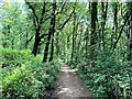
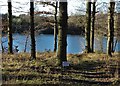
5
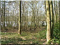
High Park Wood looking towards Moorgreen reservoir
Image: © JThomas
Taken: 17 Apr 2010
0.13 miles
6
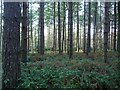
Through the trees
Morning Springs wood, mixed deciduous and coniferous woodland. The undergrowth is a mixture of brambles, bracken & grass, & there are also rhododendrons.
Image: © Lynne Kirton
Taken: 14 Jan 2007
0.16 miles
7
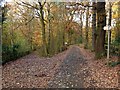
Broxtowe Country Trail in Beauvale woods
The trail divides here from the private drive to Beauvale House.
Image: © Alan Murray-Rust
Taken: 12 Nov 2018
0.18 miles
8
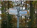
Broxtowe Country Trail fingerpost
Described as “a long distance trail which roughly follows the boundary between Broxtowe Borough and Nottingham City”, here it is well away from Nottingham City, and close to Ashfield District. For more information see https://www.broxtowe.gov.uk/media/1850/broxtowe-country-trail-guide-leaflet.pdf.
See http://www.geograph.org.uk/photo/5975320 for location.
Image: © Alan Murray-Rust
Taken: 12 Nov 2018
0.19 miles
9
Moorgreen Reservoir and woodland
Late evening November light picks out a fallen tree and its stump.
Image: © Andy Stephenson
Taken: 10 Nov 2011
0.19 miles
10
Moorgreen Reservoir through the trees
Unfortunately, public access to the waterside is disallowed for the whole eastern length of Moorgreen Reservoir.
Image: © Neil Theasby
Taken: 28 Jan 2019
0.20 miles