IMAGES TAKEN NEAR TO
Halls Lane, NOTTINGHAM, NG16 2DE
Introduction
This page details the photographs taken nearby to Halls Lane, NG16 2DE by members of the Geograph project.
The Geograph project started in 2005 with the aim of publishing, organising and preserving representative images for every square kilometre of Great Britain, Ireland and the Isle of Man.

There are currently over 7.5m images from over14,400 individuals and you can help contribute to the project by visiting https://www.geograph.org.uk
Image Map
Images are licensed for reuse under creativecommons.org/licenses/by-sa/2.0
Notes
- Clicking on the map will re-center to the selected point.
- The higher the marker number, the further away the image location is from the centre of the postcode.
Image Listing (11 Images Found)
Images are licensed for reuse under creativecommons.org/licenses/by-sa/2.0
Image
Details
Distance
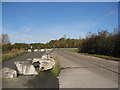
1
Newthorpe sewage treatment works
Seen from the public footpath outside the fence. Operated by Severn Trent Water.
Image: © Christine Johnstone
Taken: 21 Jun 2019
0.03 miles
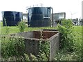
2
Newthorpe Sewage Treatment Works
Severn Trent Water's plant between Ilkeston and Eastwood.
Image: © Garth Newton
Taken: 22 Oct 2003
0.07 miles
3
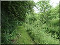
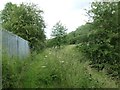
Overgrown path on the eastern perimeter of the sewage works
Not easy if you are tall! The ground appears to have been mown, but shrubs and bushes are overhanging the security fence.
Image: © Christine Johnstone
Taken: 21 Jun 2019
0.09 miles
4
Public footpath, eastern perimeter of Newthorpe sewage works
Between the perimeter fence and a small drain.
Image: © Christine Johnstone
Taken: 21 Jun 2019
0.13 miles
5
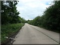
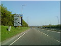
Halls Lane heading north to the A610
Access for Severn Trent Water's Newthorpe sewage works and wind turbine.
Image: © Christine Johnstone
Taken: 21 Jun 2019
0.17 miles
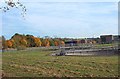
6
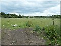
Farmland on the south side of the A610, near Giltbrook
Previously opencast? About 65 metres above sea level.
Image: © Christine Johnstone
Taken: 21 Jun 2019
0.17 miles
7
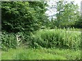
Footbridge on the public footpath near Gilt Brook
In the absence of signs, confirmation that this is the route of the footpath.
Image: © Christine Johnstone
Taken: 21 Jun 2019
0.20 miles
9
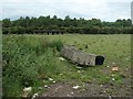
Building in a field, on the south side of the A610
I thought it was a stable, but there is no gate to keep any horses in the field.
Image: © Christine Johnstone
Taken: 21 Jun 2019
0.24 miles