IMAGES TAKEN NEAR TO
The Ropewalk, NOTTINGHAM, NG1 5DJ
Introduction
This page details the photographs taken nearby to The Ropewalk, NG1 5DJ by members of the Geograph project.
The Geograph project started in 2005 with the aim of publishing, organising and preserving representative images for every square kilometre of Great Britain, Ireland and the Isle of Man.

There are currently over 7.5m images from over14,400 individuals and you can help contribute to the project by visiting https://www.geograph.org.uk
Image Map
Images are licensed for reuse under creativecommons.org/licenses/by-sa/2.0
Notes
- Clicking on the map will re-center to the selected point.
- The higher the marker number, the further away the image location is from the centre of the postcode.
Image Listing (906 Images Found)
Images are licensed for reuse under creativecommons.org/licenses/by-sa/2.0
Image
Details
Distance
1
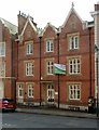
17 Regent Street, Nottingham
House, now offices, and attached area railings. Dated 1844, restored late C20. Red brick with rendered basement, ashlar and brick dressings, Jacobean Revival style, Listed Grade II.
Image: © Alan Murray-Rust
Taken: 8 Apr 2019
0.02 miles
2

19 Regent Street, Nottingham
House, now offices. Mid C19, restored and altered late C20. Red brick with ashlar dressings, Listed Grade II.
Image: © Alan Murray-Rust
Taken: 8 Apr 2019
0.02 miles
3
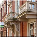
Porch and balconies, 19 Regent Street, Nottingham
See http://www.geograph.org.uk/photo/6117477 for location.
Image: © Alan Murray-Rust
Taken: 8 Apr 2019
0.02 miles
5
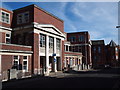
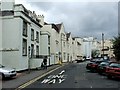
Nottingham - NG1
Buildings that once formed part of The General Hospital lining one side of Rope Walk. The buildings in the distance (also ex-General Hospital premises), including the one with the cone-shaped roof, are situated on Park Row. Why was this named Rope Walk? It seems that rope makers of yesteryear were accustomed to finishing off the rope making process in a rope walk. A rope walk is a long straight narrow lane – either enclosed within a building or open to the elements - where long strands of the fibre being used were laid out straight before being twisted into rope. The yarns were stretched out between revolving hooks, often 300 yards apart, and the hooks then twisted in order to intertwine the yarns. Perhaps rope making occurred in this area?
Image: © David Hallam-Jones
Taken: 25 Mar 2012
0.03 miles
6
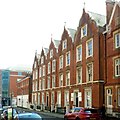
7 ? 15 Regent Street, Nottingham
5 terraced houses, now offices, and attached area railings, steps and gate piers. 1850-54. By TC Hine of Nottingham. Restored late C20. Red brick, with painted ashlar dressings, Listed Grade II. Noticeably restrained compared with Hine's two terraces on the opposite side of the road.
Image: © Alan Murray-Rust
Taken: 8 Apr 2019
0.03 miles
8
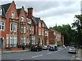
Regent Street
Leading up to The Ropewalk. Fancy neo-Jacobean gables.
Image: © John Sutton
Taken: 21 Nov 2009
0.03 miles
9

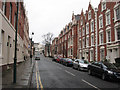
Oxford Street
Looking down the hill from The Ropewalk towards Regent Street and Wellington Circus. These streets west of the mediaeval core of Nottingham were some of its first inner suburbs. The spire of Pugin's Roman Catholic Cathedral shows above the trees of Wellington Circus.
Image: © John Sutton
Taken: 26 May 2014
0.03 miles