
Nottingham - NG1
Introduction
The photograph on this page of Nottingham - NG1 by David Hallam-Jones as part of the Geograph project.
The Geograph project started in 2005 with the aim of publishing, organising and preserving representative images for every square kilometre of Great Britain, Ireland and the Isle of Man.

There are currently over 7.5m images from over 14,400 individuals and you can help contribute to the project by visiting https://www.geograph.org.uk
Nottingham - NG1
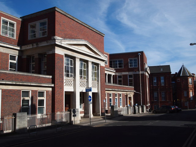
Image: © David Hallam-Jones Taken: 25 Mar 2012
Buildings that once formed part of The General Hospital lining one side of Rope Walk. The buildings in the distance (also ex-General Hospital premises), including the one with the cone-shaped roof, are situated on Park Row. Why was this named Rope Walk? It seems that rope makers of yesteryear were accustomed to finishing off the rope making process in a rope walk. A rope walk is a long straight narrow lane – either enclosed within a building or open to the elements - where long strands of the fibre being used were laid out straight before being twisted into rope. The yarns were stretched out between revolving hooks, often 300 yards apart, and the hooks then twisted in order to intertwine the yarns. Perhaps rope making occurred in this area?
Images are licensed for reuse under creativecommons.org/licenses/by-sa/2.0
Image Location

Latitude
52.952229
Longitude
-1.15722