1
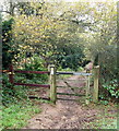
Public footpath in Newstead Priory Wood - 2
Heading south with the fencing on the right guarding the High Leys Drive housing estate.
Image: © Trevor Rickard
Taken: 24 Oct 2009
0.03 miles
2
Haggnook Wood
A general view along this sparsely populated cul-de-sac.
Image: © David Hallam-Jones
Taken: 16 Nov 2014
0.06 miles
3
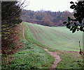
Footpath by Haggnook Wood
Heading south along the edge of the wood, with arable land on the right.
Image: © Trevor Rickard
Taken: 24 Oct 2009
0.07 miles
4
Robin Hood Way, towards Knightcross Dale
This section of the path is a 25 minute walk 'in' from the B6020 (the Ravenshead-Kirkby in Ashfield road) in the Newstead Abbey direction.
Image: © David Hallam-Jones
Taken: 16 Nov 2014
0.09 miles
5
Robin Hood Way, towards Ravenshead
Newstead Abbey is a 25-30 minute walk away behind the photographer (approximately). At this point a walker is a 15 minute walk away from the B6020 (the Ravenshead-Kirkby in Ashfield road) ahead. On the left behind the fence and parallel with the path (though not visible) are houses on High Leys Drive cluster of side roads . The stone wall is a boundary wall belonging to one of the houses on Haggnook Wood (road name).
Image: © David Hallam-Jones
Taken: 16 Nov 2014
0.11 miles
6
Robin Hood Way, Ravenshead
This section of the path is a 15 minute walk 'in' from the B6020 (the Ravenshead-Kirkby in Ashfield road) towards Newstead Abbey. There are a cluster of residentially lined side roads beyond the fence on the right.
Image: © David Hallam-Jones
Taken: 16 Nov 2014
0.11 miles
7
Public footpath in Newstead Priory Wood - 1
Looking north from the back of the High Leys Drive housing estate. The small sign indicates that this patch of woodland is managed by the Woodland Trust.
http://www.woodlandtrust.org.uk/en/our-woods/Pages/wood-details.aspx?wood=4689&site=Newstead-Priory-Wood
Image: © Trevor Rickard
Taken: 24 Oct 2009
0.12 miles
8
Robin Hood Way, towards Ravenshead
A view in the Ravenshead direction from the Knightcross Dale area. The housing units are at the southern extreme of Highfields Drive - a side road off High Leys Drive, Ravenshead.
Image: © David Hallam-Jones
Taken: 16 Nov 2014
0.13 miles
9
Robin Hood Way, Ravenshead
2-3 minutes after leaving the B6020 (the Ravenshead-Kirkby-in-Ashfield Road) walkers heading towards Newstead Abbey arrive here. A local person has named this copse "Gruffalo Wood" and has erected a metal name-plaque (complete with an engraved picture of a Gruffalo) on a post beside the footpath as it skirts the copse.
Image: © David Hallam-Jones
Taken: 16 Nov 2014
0.14 miles
10
Seat near Gunthorpe Hagg Wood
Looking north along the public footpath to the Houses at High Leys Drive.
Image: © Trevor Rickard
Taken: 24 Oct 2009
0.15 miles


