IMAGES TAKEN NEAR TO
Hall Lane, NOTTINGHAM, NG15 8EY
Introduction
This page details the photographs taken nearby to Hall Lane, NG15 8EY by members of the Geograph project.
The Geograph project started in 2005 with the aim of publishing, organising and preserving representative images for every square kilometre of Great Britain, Ireland and the Isle of Man.

There are currently over 7.5m images from over14,400 individuals and you can help contribute to the project by visiting https://www.geograph.org.uk
Image Map
Images are licensed for reuse under creativecommons.org/licenses/by-sa/2.0
Notes
- Clicking on the map will re-center to the selected point.
- The higher the marker number, the further away the image location is from the centre of the postcode.
Image Listing (35 Images Found)
Images are licensed for reuse under creativecommons.org/licenses/by-sa/2.0
Image
Details
Distance
1
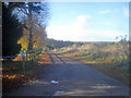
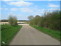
Track off Hall Lane
Heading west. If the visitor is in any doubt, the sign reads 'PRIVATE ROAD No access without permission'. Also the entrance to Papplewick & Linby Cricke Club, which uses part of the Papplewick Hall grounds.
http://www.papplewickandlinbycc.co.uk/history.php
Image: © Trevor Rickard
Taken: 7 Nov 2009
0.02 miles
2
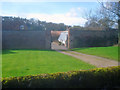
Walled Garden off Hall Lane
Looking west from Hall Lane to a walled garden complete with greenhouse inside. Part of the Papplewick Hall estate (see Image).
Image: © Trevor Rickard
Taken: 7 Nov 2009
0.03 miles
3
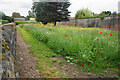
Wild flower display in Papplewick
My camera does not really pick up the vibrancy of such a display.
Image: © Bill Boaden
Taken: 2 Jul 2022
0.03 miles
4
Jack O' Sherwood Woods
from near Papplewick Hall
Image: © Tom Courtney
Taken: 15 Aug 2005
0.07 miles
6
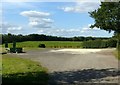
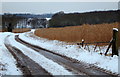
Fields near Home Farm, Papplewick (1)
Image: © Richard Vince
Taken: 10 Nov 2013
0.08 miles
7
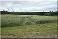
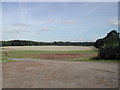
Wheat field near Papplewick
Part of the farmland attached to Newstead Grange.
Image: © Bill Boaden
Taken: 2 Jul 2022
0.09 miles
8
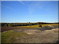
Farm stacking area
Alongside the drive to Newstead Abbey near Papplewick Hall, part of the Robin Hood Way.
Image: © Alan Murray-Rust
Taken: 13 Sep 2019
0.10 miles
9
Fields near Home Farm, Papplewick (2)
Image: © Richard Vince
Taken: 10 Nov 2013
0.11 miles
10
Hall Farm Area, NG15
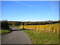
A farm track off the Robin Hood Trail heading towards Quarry Bank Farm. Particularly noticeable are fields of Miscanthus Giganteus ("Elephant Grass") whose uses include horse bedding, garden mulch and most importantly, as a biofuel that can be burned alongside coal or alone in small scale combined heat and power (CHP) units.
Image: © David Hallam-Jones
Taken: 15 Jan 2013
0.11 miles