1
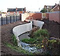
Wollaton Street Vicinity, Hucknall, Notts.
The pedestrian on the pavement parallel with the new 'town centre relief road' is walking towards its junction with Station Road. This road was opened in November 2016. The overall scheme received final funding approval from the Department for Transport in February 2015 (procured using the Medium Scheme Framework 2, through the Midlands Highway Alliance). Carillion/Tarmac JV were awarded the contract and work started on site in January 2016. The work, including a pedestrianised section of High Street - between Baker Street and Watnall Road - is due to be completed in May 2017. The overall scheme aims to reduce traffic congestion, create an attractive shopping centre, attract new retailers and to assist in the regeneration of the town. The plans also incorporated flood relief measures, part of which are seen here. This stream, the Whyburn, has a total length of around 2.5 miles (4.0 km), and terminates in a confluence with the River Leen immediately upstream of Mill Lakes, Bestwood Village.
Image: © David Hallam-Jones
Taken: 17 Dec 2016
0.06 miles
2
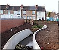
Albert Street Vicinity, Hucknall, Notts.
This 'town centre relief road' is a feature of Hucknall’s current town centre improvement scheme (TCIS). It was opened in November 2016. This is a view from its mid-point (approx) between the new Annesley Road mini-roundabout the Station Road/Ashgate Road area. Buses travelling towards Nottingham from the Wighay area of Hucknall now turn right near the car seen here in order to rejoin High Street. The overall improvement scheme received final funding approval from the Department for Transport in February 2015 (procured using the Medium Scheme Framework 2, through the Midlands Highway Alliance). Carillion/Tarmac JV were awarded the contract and work started on site in January 2016. The work, including a pedestrianised section of High Street between Baker Street and Watnall Road, is due to be completed in May 2017. The overall scheme aims to reduce traffic congestion, create an attractive shopping centre, attract new retailers and to assist in the regeneration of the town. Flood prevention measures are being strengthen simultaneously, as part of the project.
Image: © David Hallam-Jones
Taken: 17 Dec 2016
0.06 miles
3
Wollaton Street Vicinity, Hucknall, Notts.
The works depot for the new 'town centre relief road' is visible ahead. The road was opened in November 2016. The overall scheme received final funding approval from the Department for Transport in February 2015 (procured using the Medium Scheme Framework 2, through the Midlands Highway Alliance). Carillion/Tarmac JV were awarded the contract and work started on site in January 2016. The work, including a pedestrianised section of High Street - between Baker Street and Watnall Road - is due to be completed in May 2017. The overall scheme aims to reduce traffic congestion, create an attractive shopping centre, attract new retailers and to assist in the regeneration of the town. The plans also incorporated flood relief measures, some of which are seen here. This stream, the Whyburn, has a total length of around 2.5 miles (4.0 km), and terminates in a confluence with the River Leen immediately upstream of Mill Lakes, Bestwood Village.
Image: © David Hallam-Jones
Taken: 17 Dec 2016
0.07 miles
4
Albert Street
An early development of terraced houses from the time when the coal industry really got going in Hucknall.
An interesting mixture of stone and brick construction, it appears that the stone is used only for the façade with the remainder of the building being of brick construction. This can be seen on the gable end where the three storey houses start, but was also clear from other observations.
Image: © Alan Murray-Rust
Taken: 7 Jun 2010
0.07 miles
5
Town Centre Relief Road, Hucknall, Notts.
This 'town centre relief road' is a feature of Hucknall’s current town centre improvement scheme (TCIS). It was opened in November 2016. This is a view from near the town centre end of Annesley Road, looking towards Station Road/Ashgate Road. Buses travelling towards Nottingham from the Wighay area of Hucknall now turn right behind the on-coming white car in order to rejoin High Street. The overall scheme received final funding approval from the Department for Transport in February 2015 (procured using the Medium Scheme Framework 2, through the Midlands Highway Alliance). Carillion/Tarmac JV were awarded the contract and work started on site in January 2016. The work, that includes a pedestrianised section of High Street between Baker Street and Watnall Road, is due to be completed in May 2017. The overall scheme aims to reduce traffic congestion, create an attractive shopping centre, attract new retailers and to assist in the regeneration of the town. Flood prevention measures are being strengthen simultaneously, as part of the project.
Image: © David Hallam-Jones
Taken: 17 Dec 2016
0.08 miles
6
Carpark off Station Road
Wollaton Street behind.
Image: © Chris
Taken: 13 May 2014
0.09 miles
7
Hucknall Leisure Centre
The nearest building is the latest addition to the complex.
Image: © Alan Murray-Rust
Taken: 7 Jun 2010
0.09 miles
8
Bus Gate, High Street, Hucknall, Notts.
Now that vehicles can no longer be driven along the Watnall Lane-Baker Street section of High Street, a new "buses only" link road has been created to connect the Portland Road end of High Street with the recently completed relief road (ahead).
Image: © David Hallam-Jones
Taken: 17 Dec 2016
0.11 miles
9
Woollaton Street
Runs northward off the High Street.
Image: © David Lally
Taken: 13 Mar 2010
0.11 miles
10
Linby Grove
Late Victorian cul-de-sac off Linby Road.
Image: © Alan Murray-Rust
Taken: 7 Jun 2010
0.12 miles


