Town Centre Relief Road, Hucknall, Notts.
Introduction
The photograph on this page of Town Centre Relief Road, Hucknall, Notts. by David Hallam-Jones as part of the Geograph project.
The Geograph project started in 2005 with the aim of publishing, organising and preserving representative images for every square kilometre of Great Britain, Ireland and the Isle of Man.

There are currently over 7.5m images from over 14,400 individuals and you can help contribute to the project by visiting https://www.geograph.org.uk
Town Centre Relief Road, Hucknall, Notts.
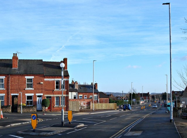
Image: © David Hallam-Jones Taken: 17 Dec 2016
This 'town centre relief road' is a feature of Hucknall’s current town centre improvement scheme (TCIS). It was opened in November 2016. This is a view from near the town centre end of Annesley Road, looking towards Station Road/Ashgate Road. Buses travelling towards Nottingham from the Wighay area of Hucknall now turn right behind the on-coming white car in order to rejoin High Street. The overall scheme received final funding approval from the Department for Transport in February 2015 (procured using the Medium Scheme Framework 2, through the Midlands Highway Alliance). Carillion/Tarmac JV were awarded the contract and work started on site in January 2016. The work, that includes a pedestrianised section of High Street between Baker Street and Watnall Road, is due to be completed in May 2017. The overall scheme aims to reduce traffic congestion, create an attractive shopping centre, attract new retailers and to assist in the regeneration of the town. Flood prevention measures are being strengthen simultaneously, as part of the project.
Images are licensed for reuse under creativecommons.org/licenses/by-sa/2.0
Image Location
Latitude
53.039472
Longitude
-1.202948