
IMAGES TAKEN NEAR TO
Caythorpe Road, NOTTINGHAM, NG14 7DZ
Introduction
This page details the photographs taken nearby to Caythorpe Road, NG14 7DZ by members of the Geograph project.
The Geograph project started in 2005 with the aim of publishing, organising and preserving representative images for every square kilometre of Great Britain, Ireland and the Isle of Man.

There are currently over 7.5m images from over14,400 individuals and you can help contribute to the project by visiting https://www.geograph.org.uk
Image Map
Images are licensed for reuse under creativecommons.org/licenses/by-sa/2.0
Notes
- Clicking on the map will re-center to the selected point.
- The higher the marker number, the further away the image location is from the centre of the postcode.
Image Listing (21 Images Found)
Images are licensed for reuse under creativecommons.org/licenses/by-sa/2.0
Image
Details
Distance
1
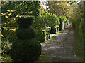
Bridleway near Lowdham
South of the railway, the bridleway provides access to a number of large detached houses.
Image: © Alan Murray-Rust
Taken: 16 Oct 2009
0.01 miles
2
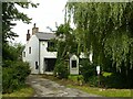
Freiston, Caythorpe Road
A cottage dating back to the early 19th century, originally a small farmhouse with attached smallholding farm. See http://www.geograph.org.uk/photo/6901528
Image: © Alan Murray-Rust
Taken: 13 Jul 2021
0.05 miles
3
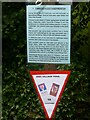
Caythorpe WW2 Village Trail, July 2021 ? No.1
Information relating to the cottage named Freiston. See also http://www.geograph.org.uk/photo/6901530
Image: © Alan Murray-Rust
Taken: 13 Jul 2021
0.06 miles
4
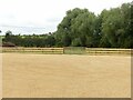
The new car park for The Old Volunteer at Caythorpe
This https://www.geograph.org.uk/photo/6804057 was the view when I passed by a few weeks earlier. I had been puzzled by why such a small area of cultivation was being worked, but this explains. The cultivation was clearly simply to break up the surface growth for removal prior to laying the gravel surface.
Image: © Alan Murray-Rust
Taken: 13 Jul 2021
0.06 miles
5
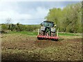
Doing a bit of cultivation
Using a disk cultivator to tidy up a small piece of land. This appears to have been a second pass after previously working across the field. The uncultivated are beyond the tractor still shows medieval ridge and furrow formation.
Image: © Alan Murray-Rust
Taken: 6 Apr 2021
0.07 miles
6
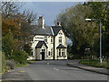
The Old Volunteer
Attractive Victorian pub on the Lowdham to Caythorpe Road.
Image: © Alan Murray-Rust
Taken: 16 Oct 2009
0.09 miles
7
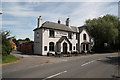
The Old Volunteer
Popular hostelry in Lowdham
Image: © Richard Croft
Taken: 10 Jul 2010
0.10 miles
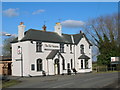
9
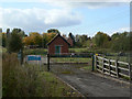
Sewage Pumping Station
The low lying land round here means that sewage has to be pumped up to the treatment works. This station is on Caythorpe Road.
Image: © Alan Murray-Rust
Taken: 16 Oct 2009
0.10 miles
10
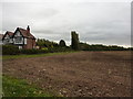
Mock Tudor semi at corner of fields
Stubble remains after harvesting.
Image: © Peter Barr
Taken: 12 Oct 2011
0.15 miles