
IMAGES TAKEN NEAR TO
Old Epperstone Road, NOTTINGHAM, NG14 7BW
Introduction
This page details the photographs taken nearby to Old Epperstone Road, NG14 7BW by members of the Geograph project.
The Geograph project started in 2005 with the aim of publishing, organising and preserving representative images for every square kilometre of Great Britain, Ireland and the Isle of Man.

There are currently over 7.5m images from over14,400 individuals and you can help contribute to the project by visiting https://www.geograph.org.uk
Image Map
Images are licensed for reuse under creativecommons.org/licenses/by-sa/2.0
Notes
- Clicking on the map will re-center to the selected point.
- The higher the marker number, the further away the image location is from the centre of the postcode.
Image Listing (21 Images Found)
Images are licensed for reuse under creativecommons.org/licenses/by-sa/2.0
Image
Details
Distance
1
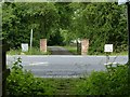
The lane to Epperstone Mill
Also serving as a public bridleway as far as the mill. The lane continues behind the camera, but is intersected by the 20th century Epperstone bypass. The southern part retains bridleway status but is really only usable by pedestrians http://www.geograph.org.uk/photo/6509334
Image: © Alan Murray-Rust
Taken: 13 Jun 2020
0.03 miles
2
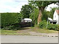
The lane to Epperstone Mill
Until the building of the bypass http://www.geograph.org.uk/photo/6509331 this was the access to the mill. Although classified as a bridleway it is effectively only passable by pedestrians as the premises to the left have encroached on the original lane.
Image: © Alan Murray-Rust
Taken: 13 Jun 2020
0.04 miles
3
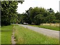
Old Epperstone Road
Improved as part of the construction of what is now the A6097 in the inter-war period when the Epperstone and Lowdham bypasses were built, itself bypassed in the 1970s.
Image: © Alan Murray-Rust
Taken: 1 Jul 2020
0.04 miles
4
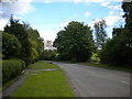
Old Epperstone Road near Lowdham
Now basically demoted to a service road. The current through road, the A6097, passes a little way to the north.
Image: © Richard Vince
Taken: 14 May 2014
0.06 miles
5
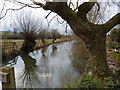
Pollarded willows at mill pond, Dover Beck
Image: © Peter Barr
Taken: 9 Mar 2010
0.07 miles
6
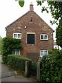
Epperstone Mill
The southern end of the mill, being the later part, probably built following the fire in the early 19th century http://www.geograph.org.uk/photo/6509314 . Listed Grade II.
Image: © Alan Murray-Rust
Taken: 13 Jun 2020
0.08 miles
7
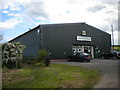
Agricultural equipment shop near Lowdham
Apparently incorporating a tractor service centre.
Image: © Richard Vince
Taken: 14 May 2014
0.09 miles
8
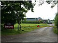
Sharmans Agricultural, Epperstone
Dealing in modern agricultural machinery. There is a public footpath along the verge of the track, passing between the nearer shed and the hedge.
Image: © Alan Murray-Rust
Taken: 13 Jun 2020
0.09 miles
9
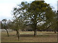
Mistletoe and snowdrops
In an orchard by Dover Beck, Lowdham
Image: © Peter Barr
Taken: 9 Mar 2010
0.10 miles
10
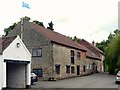
Epperstone Mill
Originally a corn mill, later a paper mill. The buildings date from the mid 18th century, rebuilt following a fire (sources give either 1809 or 1828), the latest section being at the far end. Listed Grade II.
Image: © Alan Murray-Rust
Taken: 13 Jun 2020
0.10 miles