1
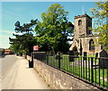
Calverton Working Men's Club
Image: © David Howard
Taken: 16 Jul 2023
0.03 miles
2
Signs at the junction of Collyer Road and Mansfield Lane
There is a pair of similar ones with short arrows opposite but I missed them.
Image: © David Howard
Taken: 16 Jul 2023
0.03 miles
3
Green on Mansfield Lane, Calverton
Image: © David Howard
Taken: 16 Jul 2023
0.04 miles
4
Colliery reminder
Calverton Colliery opened in 1952 and closed in 1999.
Image: © Jonathan Thacker
Taken: 17 Sep 2021
0.04 miles
5
Buildings on Main Street (50-64)
A mixture of older and newer buildings, within the Conservation Area.
Image: © Alan Murray-Rust
Taken: 14 Aug 2011
0.05 miles
6
Calverton NG14, Notts.
St Wilfrid's Church on Main Street looking towards the public library and the shopping precinct, St Wilfrid's Square. Domesday book records show the existence of a church on this site in 1086 although what users and visitors see today stems from the late C13th and C14th, with the nave and tower having been rebuilt in 1763 and the chancel in 1835. The building is Grade-II listed with Grade I upgrading currently being sought.
Image: © David Hallam-Jones
Taken: 26 May 2013
0.06 miles
7
Baptist Chapel, The Nook
The inscribed stone in the gable carries the date 1832. This is now the Baptist Church Hall, the congregation having taken over the former Primitive Methodist Church on Main Street http://www.geograph.org.uk/photo/2559185.
Image: © Alan Murray-Rust
Taken: 14 Aug 2011
0.06 miles
8
Calverton NG14, Notts.
This former Baptist Chapel is off Main Street, obliquely opposite the Baptists' current church, adjacent to the small Folk Museum. "The Nook" is now a cul-de-sac with 'pedestrian access only' to a car park off Mansfield Lane.
Image: © David Hallam-Jones
Taken: 26 May 2013
0.06 miles
9
Museum Cottage, Calverton
Cottage, now a museum, dating from 1780 https://historicengland.org.uk/listing/the-list/list-entry/1235916
Image: © Jonathan Thacker
Taken: 17 Sep 2021
0.06 miles
10
Baptist Church, Main Street
Originally the Primitive Methodist Church, as indicated in the stone band in the main gable. The original Baptist Chapel on The Nook http://www.geograph.org.uk/photo/2559190 is now the Baptist Church Hall.
Image: © Alan Murray-Rust
Taken: 14 Aug 2011
0.06 miles


