IMAGES TAKEN NEAR TO
Woodborough, NOTTINGHAM, NG14 6EN
Introduction
This page details the photographs taken nearby to NG14 6EN by members of the Geograph project.
The Geograph project started in 2005 with the aim of publishing, organising and preserving representative images for every square kilometre of Great Britain, Ireland and the Isle of Man.

There are currently over 7.5m images from over14,400 individuals and you can help contribute to the project by visiting https://www.geograph.org.uk
Image Map
Images are licensed for reuse under creativecommons.org/licenses/by-sa/2.0
Notes
- Clicking on the map will re-center to the selected point.
- The higher the marker number, the further away the image location is from the centre of the postcode.
Image Listing (14 Images Found)
Images are licensed for reuse under creativecommons.org/licenses/by-sa/2.0
Image
Details
Distance
1
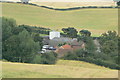
Wood Farm
View from George's Lane near Dorket Head farm.
Image: © Alan Murray-Rust
Taken: 20 Jul 2010
0.03 miles
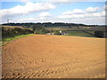
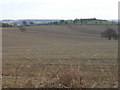
2
Landscape near Woodborough Park
Large expanses of cereal stubble following harvesting.
Image: © Alan Murray-Rust
Taken: 21 Aug 2011
0.13 miles
3

Vehicular access to Wood Farm
The sign proclaims Wood Farm to be in Woodborough, presumably because it is considered more upmarket than either Arnold or Calverton (both of which appear to be closer to the farm, certainly so by road).
Image: © Richard Vince
Taken: 4 Oct 2016
0.17 miles
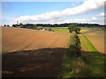
5
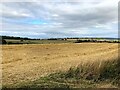
Cut Crop Field at Dorket Head
Pictured from the field exit where the path meets Woodborough Lane.
Image: © Jonathan Clitheroe
Taken: 9 Sep 2024
0.19 miles
6
Landscape near Woodborough Park
Large expanses of cereal stubble following harvesting.
Image: © Alan Murray-Rust
Taken: 21 Aug 2011
0.19 miles
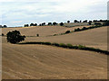
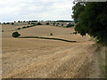
7

Fields north of Wood Farm
The wind turbine that provides power to Woodborough Park Farm is visible in the distance.
Image: © Richard Vince
Taken: 4 Oct 2016
0.20 miles
8
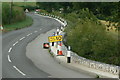
George's Lane
This is the main road from Nottingham to Calverton, but was closed to through traffic at this time for major remedial work, some of which can be seen here.
Image: © Alan Murray-Rust
Taken: 20 Jul 2010
0.22 miles