IMAGES TAKEN NEAR TO
Pinfold Crescent, NOTTINGHAM, NG14 6DQ
Introduction
This page details the photographs taken nearby to Pinfold Crescent, NG14 6DQ by members of the Geograph project.
The Geograph project started in 2005 with the aim of publishing, organising and preserving representative images for every square kilometre of Great Britain, Ireland and the Isle of Man.

There are currently over 7.5m images from over14,400 individuals and you can help contribute to the project by visiting https://www.geograph.org.uk
Image Map
Images are licensed for reuse under creativecommons.org/licenses/by-sa/2.0
Notes
- Clicking on the map will re-center to the selected point.
- The higher the marker number, the further away the image location is from the centre of the postcode.
Image Listing (84 Images Found)
Images are licensed for reuse under creativecommons.org/licenses/by-sa/2.0
Image
Details
Distance
1
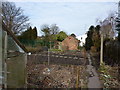
On a public footpath through allotment gardens
Image: © Peter Barr
Taken: 9 Mar 2010
0.05 miles
2
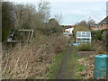
Church Walk
These appear to be private gardens rather than official allotments. The path is a right of way.
Image: © Alan Murray-Rust
Taken: 20 Mar 2011
0.05 miles
3
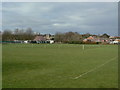
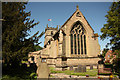
Woodborough playing fields
The cricket square in the foreground, with the village and church as backdrop.
Image: © Alan Murray-Rust
Taken: 20 Mar 2011
0.06 miles
4
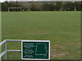
Woodborough playing fields
The designated line of the public footpath follows the perimeter as the notice requests.
Image: © Alan Murray-Rust
Taken: 20 Mar 2011
0.07 miles
5
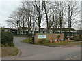
Wood's Foundation School, third generation
This is the third school in the village, the original establishment dating back to 1736, founded by the Wood family. This was superseded by a new public school in 1878 which in turn was replaced by the current building in 1968. Throughout its history the school has had Church of England support in one form or another.
The current building uses the CLASP modular system of construction developed by authorities in the East Midlands to be able to cope with mining subsidence.
Image: © Alan Murray-Rust
Taken: 20 Mar 2011
0.07 miles
6
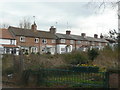
Church Walk
A row of cottages facing onto the stream through the village which runs below the metal fence. The rough ground is the site of the later village Co-operative store, closed just a few years ago.
Image: © Alan Murray-Rust
Taken: 20 Mar 2011
0.07 miles
7
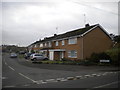
Housing on Pinfold Close, Woodborough
Off Main Street near to the centre of the village.
Image: © Richard Vince
Taken: 25 Oct 2014
0.07 miles
8
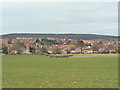
Woodborough village
A view across the fields from the south, showing just how much the village has expanded as a commuter dormitory for Nottingham.
Image: © Alan Murray-Rust
Taken: 20 Mar 2011
0.08 miles
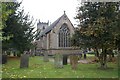
10
St.Swithun's church
Delightful five-light curvilinear east window in St.Swithun's chancel, built in the 14th century by Richard de Strelley whose arms can be seen in the apex of the gable
Image: © Richard Croft
Taken: 4 Jun 2013
0.09 miles