IMAGES TAKEN NEAR TO
Conery Gardens, NOTTINGHAM, NG13 9FD
Introduction
This page details the photographs taken nearby to Conery Gardens, NG13 9FD by members of the Geograph project.
The Geograph project started in 2005 with the aim of publishing, organising and preserving representative images for every square kilometre of Great Britain, Ireland and the Isle of Man.

There are currently over 7.5m images from over14,400 individuals and you can help contribute to the project by visiting https://www.geograph.org.uk
Image Map
Images are licensed for reuse under creativecommons.org/licenses/by-sa/2.0
Notes
- Clicking on the map will re-center to the selected point.
- The higher the marker number, the further away the image location is from the centre of the postcode.
Image Listing (27 Images Found)
Images are licensed for reuse under creativecommons.org/licenses/by-sa/2.0
Image
Details
Distance
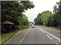
2
Conery Lane, Whatton
The lane was cut when the A52 was improved to bypass the village.
Image: © Alan Murray-Rust
Taken: 27 Apr 2014
0.08 miles
3
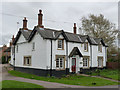
The White House, Conery Lane
Attractive Victorian house with stone window surrounds and distinctive hood moulds.
Image: © Alan Murray-Rust
Taken: 6 Apr 2014
0.14 miles
4
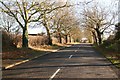
Old Grantham Road
Looking towards Whatton-in-the-Vale along the old main road
Image: © Richard Croft
Taken: 3 Dec 2008
0.14 miles
5
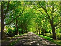
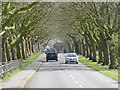
Tree Lined Avenue - Whatton in the Vale
Image: © Ruth Russell
Taken: 17 Jul 2016
0.14 miles
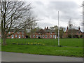
6
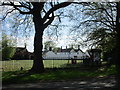
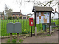
The Village Green, Whatton in the Vale
Image: © Jonathan Thacker
Taken: 14 May 2016
0.15 miles
7
Ivy Row, Whatton
A line of attractive brick cottages on the south side of Whatton Green.
Image: © Alan Murray-Rust
Taken: 6 Apr 2014
0.16 miles
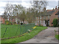
8
The Green, Whatton in the Vale
Looking across to Ivy Row.
Image: © Alan Murray-Rust
Taken: 6 Apr 2014
0.16 miles
9
Postbox at Whatton Green ref NG13 342
Standard EIIR lamp box on post. Note the twin drop boxes adjacent.
Image: © Alan Murray-Rust
Taken: 6 Apr 2014
0.17 miles
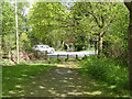
10
Old Grantham Road
This became the 'Old' road after construction of the current A52 alignment avoiding the village, but was itself a replacement (sometime between 1930 and 1952) for the original road which is situated a little to the south.
Image: © Alan Murray-Rust
Taken: 13 Apr 2014
0.17 miles