
IMAGES TAKEN NEAR TO
Trent Lane, NOTTINGHAM, NG13 8PF
Introduction
This page details the photographs taken nearby to Trent Lane, NG13 8PF by members of the Geograph project.
The Geograph project started in 2005 with the aim of publishing, organising and preserving representative images for every square kilometre of Great Britain, Ireland and the Isle of Man.

There are currently over 7.5m images from over14,400 individuals and you can help contribute to the project by visiting https://www.geograph.org.uk
Image Map
Images are licensed for reuse under creativecommons.org/licenses/by-sa/2.0
Notes
- Clicking on the map will re-center to the selected point.
- The higher the marker number, the further away the image location is from the centre of the postcode.
Image Listing (108 Images Found)
Images are licensed for reuse under creativecommons.org/licenses/by-sa/2.0
Image
Details
Distance
1
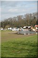
Boat Yard
Boat Yard on River Trent, near East Bridgford.
Image: © gary radford
Taken: 9 Apr 2007
0.04 miles
2
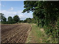
Trent Valley Way heading north-west from East Bridgford
The Way runs parallel to Trent Lane, which is sunk down to the right of the hedge.
Image: © Tim Heaton
Taken: 7 Sep 2008
0.05 miles
3
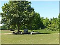
Sheep in the shade
The largely overgrown earthworks beyond are the site of a motte and bailey castle of 11th or 12th century origin. Scheduled Monument.
Image: © Alan Murray-Rust
Taken: 29 May 2020
0.05 miles
4
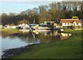
Boatyard and house near East Bridgford
Image: © Alan Murray-Rust
Taken: 6 Jan 2008
0.07 miles
5
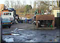
Boatyard on the River Trent
The Kingfisher Marine yard near East Bridgford. The neat little brick shed houses a winch for hauling boats up the slipway.
Image: © Alan Murray-Rust
Taken: 6 Jan 2008
0.08 miles
6
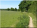
Footpath from the churchyard, East Bridgford
This runs alongside Trent Lane, keeping pedestrians out of the way of vehicles in what is effectively a hollow lane. It forms part of the Trent Valley Way.
Image: © Alan Murray-Rust
Taken: 29 May 2020
0.09 miles
7
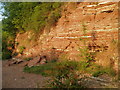
Cliffs at the south end of Gunthorpe weir
The village of Gunthorpe gives its name to the local formation of red Triassic mudstones. The white bands are gypsum.
Image: © Jim Thornton
Taken: 9 Jul 2005
0.10 miles
9
Boatyard below East Bridgford
This is the Kingfisher Marine yard on the south side of the river.
Image: © Alan Murray-Rust
Taken: 6 Jan 2008
0.11 miles
10
Boats at Kingfisher Marine, East Bridgford.
Image: © Alan Murray-Rust
Taken: 6 Jan 2008
0.11 miles