Cliffs at the south end of Gunthorpe weir
Introduction
The photograph on this page of Cliffs at the south end of Gunthorpe weir by Jim Thornton as part of the Geograph project.
The Geograph project started in 2005 with the aim of publishing, organising and preserving representative images for every square kilometre of Great Britain, Ireland and the Isle of Man.

There are currently over 7.5m images from over 14,400 individuals and you can help contribute to the project by visiting https://www.geograph.org.uk
Cliffs at the south end of Gunthorpe weir
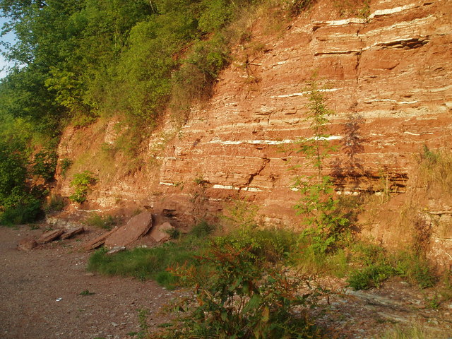
Image: © Jim Thornton Taken: 9 Jul 2005
The village of Gunthorpe gives its name to the local formation of red Triassic mudstones. The white bands are gypsum.
Images are licensed for reuse under creativecommons.org/licenses/by-sa/2.0
Image Location
Latitude
52.985332
Longitude
-0.976634