
IMAGES TAKEN NEAR TO
Main Road, NOTTINGHAM, NG12 5NB
Introduction
This page details the photographs taken nearby to Main Road, NG12 5NB by members of the Geograph project.
The Geograph project started in 2005 with the aim of publishing, organising and preserving representative images for every square kilometre of Great Britain, Ireland and the Isle of Man.

There are currently over 7.5m images from over14,400 individuals and you can help contribute to the project by visiting https://www.geograph.org.uk
Image Map
Images are licensed for reuse under creativecommons.org/licenses/by-sa/2.0
Notes
- Clicking on the map will re-center to the selected point.
- The higher the marker number, the further away the image location is from the centre of the postcode.
Image Listing (132 Images Found)
Images are licensed for reuse under creativecommons.org/licenses/by-sa/2.0
Image
Details
Distance
1
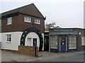
The Old Forge
The horseshoe decoration does date back to its time as a smithy, but the building has been substantially modernised. What was once the village's local store now houses a firm of solicitors.
Image: © Alan Murray-Rust
Taken: 11 Nov 2011
0.02 miles
2
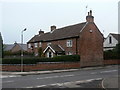
Hallcliff Cottages
The nearer house would originally have been a pair of cottages, but these have been converted into a single dwelling.
Image: © Alan Murray-Rust
Taken: 11 Nov 2011
0.03 miles
3
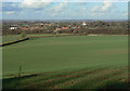
View across the Trent Valley
At the point where the footpath from Crossdale Drive to Plumtree breaks out of the built up area at the edge of the wold on which Keyworth lies. Plumtree village and church are prominent in the middle distance.
Image: © Alan Murray-Rust
Taken: 1 Nov 2011
0.03 miles
4
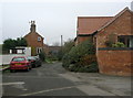
Church Lane
This was the single 'back street' of the old village.
Image: © Alan Murray-Rust
Taken: 11 Nov 2011
0.03 miles
5
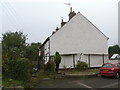
1-4 The Green
A terrace of 19th century cottages on Church Lane.
Image: © Alan Murray-Rust
Taken: 11 Nov 2011
0.04 miles
6
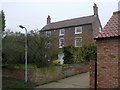
Manor Farmhouse, Plumtree
Attractive early 19th century farmhouse in red brick. Listed Grade II.
Image: © Alan Murray-Rust
Taken: 11 Nov 2011
0.04 miles
7
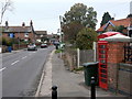
Main Road Plumtree
Looking north from the Old Post Office. The K6 telephone kiosk is mo longer in use.
Image: © Alan Murray-Rust
Taken: 11 Nov 2011
0.04 miles
8
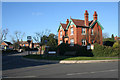
Village centre, Plumtree
Church Hill (to the right) meets Main Street (ahead) and Station Road (behind the view point) at the cross roads in the centre of Plumtree, right on the boundary of two squares. The fourth road at this staggered junction is Bradmore Lane. The large house on the junction is the Old Post Office, the village primary school is behind the photographer and the Griffin Inn, the only pub in the village, is opposite. With the church at the top of the hill this is a real village centre.
Image: © Kate Jewell
Taken: 24 Jan 2008
0.06 miles
9
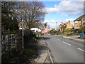
Main Road, Plumtree
Heading north out of the village, towards Nottingham. On the left is a kissing gate leading to a public footpath through a field that was occupied by sheep on this occasion.
Image: © Richard Vince
Taken: 27 Feb 2015
0.06 miles
10
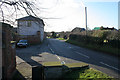
Church Hill, Plumtree
Looking down the street towards Station Road from the corner of the elevated churchyard.
Image: © Kate Jewell
Taken: 24 Jan 2008
0.07 miles