
IMAGES TAKEN NEAR TO
Colston Road, NOTTINGHAM, NG12 3BJ
Introduction
This page details the photographs taken nearby to Colston Road, NG12 3BJ by members of the Geograph project.
The Geograph project started in 2005 with the aim of publishing, organising and preserving representative images for every square kilometre of Great Britain, Ireland and the Isle of Man.

There are currently over 7.5m images from over14,400 individuals and you can help contribute to the project by visiting https://www.geograph.org.uk
Image Map
Images are licensed for reuse under creativecommons.org/licenses/by-sa/2.0
Notes
- Clicking on the map will re-center to the selected point.
- The higher the marker number, the further away the image location is from the centre of the postcode.
Image Listing (63 Images Found)
Images are licensed for reuse under creativecommons.org/licenses/by-sa/2.0
Image
Details
Distance
1
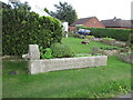
Drinking fountain used as planter
I assume this is genuine. This is wealthy south Nottinghamshire and definitely "horsey" territory. I guess many a horse on a hot day would appreciate this being put back to its original use.
Image: © Jonathan Thacker
Taken: 23 Sep 2016
0.01 miles
2
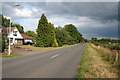
Colston Lane, Cropwell Bishop
This straight piece of road has been given a 30mph speed limit a couple of years ago although little notice seems to be taken of the signs. The homes on the left were once fairly modest bungalows in large plots which back onto the Grantham Canal, see Image The majority have been extensively developed, both upwards and sideways, over the years. In the distance the road takes a gentle curve to the left just before it crosses Blue Hill (or Colston) Bridge.
Image: © Kate Jewell
Taken: 7 Jul 2011
0.02 miles
3
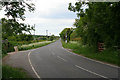
Colston Road
Looking towards the Lime Kiln public house and the Swab Lane crossroads from Blue Hill Bridge.
Image: © Kate Jewell
Taken: 20 May 2008
0.05 miles
5

The bed of the Grantham Canal, between bridges 23 and 22
Alongside the back gardens of houses on Kinoulton Road. The Grantham Canal Society is actively working to restore the canal, but it will be a long process.
Image: © Christine Johnstone
Taken: 9 May 2025
0.07 miles
6
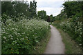
The Grantham Canal towpath
Following the 45 metre contour the canal winds its way towards Cropwell Bishop. The gardens of the houses on Colston Road come right down to the canal boundary on the left while there is open farmland to the right. Walk round the bend ahead and you have sight of the Old Mill in Image
Image: © Kate Jewell
Taken: 20 May 2008
0.08 miles
7
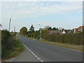
Blue Hill
Does the name derive from the Blue Lias limestone found in the vicinity?
This is an unusually isolated bit of inter-war ribbon development.
Image: © Alan Murray-Rust
Taken: 3 Oct 2011
0.08 miles
8
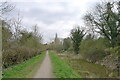
The Grantham Canal (disused) by the side of Blue Hill
The canal wanders around the edge of the Vale of Belvoir. Its towpath provides 24 miles of cycle path between Nottingham and Grantham.
Image: © Tim Heaton
Taken: 22 Mar 2021
0.10 miles
9
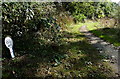
Mile marker along the disused Grantham Canal
8¾ miles from the Trent.
Image: © Mat Fascione
Taken: 6 Oct 2013
0.12 miles
10
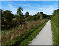
Towpath along the Grantham Canal at Cropwell Bishop
Image: © Mat Fascione
Taken: 6 Oct 2013
0.12 miles