
IMAGES TAKEN NEAR TO
Far Street, NOTTINGHAM, NG11 6PF
Introduction
This page details the photographs taken nearby to Far Street, NG11 6PF by members of the Geograph project.
The Geograph project started in 2005 with the aim of publishing, organising and preserving representative images for every square kilometre of Great Britain, Ireland and the Isle of Man.

There are currently over 7.5m images from over14,400 individuals and you can help contribute to the project by visiting https://www.geograph.org.uk
Image Map
Images are licensed for reuse under creativecommons.org/licenses/by-sa/2.0
Notes
- Clicking on the map will re-center to the selected point.
- The higher the marker number, the further away the image location is from the centre of the postcode.
Image Listing (84 Images Found)
Images are licensed for reuse under creativecommons.org/licenses/by-sa/2.0
Image
Details
Distance
1
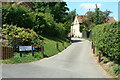
Donkey Lane
Historic back lane off Far Street.
Image: © Alan Murray-Rust
Taken: 21 Jun 2010
0.03 miles
2
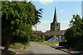
Far Street
Looking east with the church spire prominent.
Image: © Alan Murray-Rust
Taken: 21 Jun 2010
0.03 miles
3
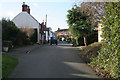
Far Street, Bradmore
Far Street runs parallel to Main Street and originally consisted mainly of labourers' cottages. The village pump is also on this street.
Image: © Kate Jewell
Taken: 24 Jan 2008
0.04 miles
4
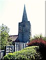
Bradmore Church Remains, Bradmore, Notts.
A passage linking Far Street (behind the photographer) with Main Street. Twelve houses, a number of barns, various stables and some workshops on Far Street and Main Street were all destroyed by a huge fire in 1701, all within a matter of hours. In addition, the church with its C13th tower and C14th spire also suffered badly, leaving only the tower and spire standing. Although the church was never rebuilt, a mission hall - adjoining the tower - was added in 1881 to allow for the provision of occasional services, and then later, as a men's institute and recreation hall. The spire was damaged by an earth tremor in 1957 and as a result, when it was repaired the opportunity was also taken to refurbish the tower room for future use.
Image: © David Hallam-Jones
Taken: 20 Apr 2018
0.04 miles
5
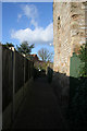
New Walk, Bradmore
This narrow walk links Main Street and Far Street. The 13th century base of the church tower is on the right.
Image: © Kate Jewell
Taken: 24 Jan 2008
0.04 miles
6
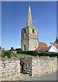
Tower and spire of former Bradmore Church
A grade II listed building, the tower and spire are all that remain of the original church which was destroyed by fire in 1705.
Image: © Graham Hogg
Taken: 25 Sep 2018
0.04 miles
7

Houses on Main Street, Bradmore
What appear to be particularly bland council houses, in the centre of the village.
Image: © Richard Vince
Taken: 6 Jun 2015
0.05 miles
8
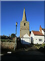
Church tower and spire, Bradmore
The tower and spire are all that remain of a medieval chapel of ease https://historicengland.org.uk/listing/the-list/list-entry/1277785?section=official-list-entry
Image: © Jonathan Thacker
Taken: 20 Jan 2023
0.05 miles
9
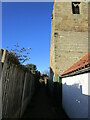
Footpath to Far Street, Bradmore
Passes the tower of Bradmore church https://historicengland.org.uk/listing/the-list/list-entry/1277785?section=official-list-entry
Image: © Jonathan Thacker
Taken: 20 Jan 2023
0.05 miles
10
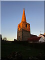
The spire at Bradmore lit by the setting sun
The tower and spire https://historicengland.org.uk/listing/the-list/list-entry/1277785?section=official-list-entry are all that remains of the medieval church at Bradmore. The rest was destroyed (together with several other buildings) by fire in 1705.
Image: © Jonathan Thacker
Taken: 20 Jan 2023
0.05 miles