
IMAGES TAKEN NEAR TO
Wibberley Drive, NOTTINGHAM, NG11 6AL
Introduction
This page details the photographs taken nearby to Wibberley Drive, NG11 6AL by members of the Geograph project.
The Geograph project started in 2005 with the aim of publishing, organising and preserving representative images for every square kilometre of Great Britain, Ireland and the Isle of Man.

There are currently over 7.5m images from over14,400 individuals and you can help contribute to the project by visiting https://www.geograph.org.uk
Image Map
Images are licensed for reuse under creativecommons.org/licenses/by-sa/2.0
Notes
- Clicking on the map will re-center to the selected point.
- The higher the marker number, the further away the image location is from the centre of the postcode.
Image Listing (39 Images Found)
Images are licensed for reuse under creativecommons.org/licenses/by-sa/2.0
Image
Details
Distance
1
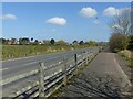
Pasture Lane, Ruddington
With the final section of housing, on Tongue Way, Pasture Lane has been improved with a completely new carriageway. To the right is the former narrow roadway, now purely for pedestrians. Compare with this view from 2010 https://www.geograph.org.uk/photo/1745373 .
Image: © Alan Murray-Rust
Taken: 18 Mar 2022
0.09 miles
2
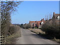
Pasture Lane
A separate road network gives access to the new housing, but this relatively narrow lane is nevertheless the main access to a large gypsum products works.
Image: © Alan Murray-Rust
Taken: 7 Mar 2010
0.10 miles
3
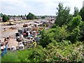
New development at Ruddington
Ruddington's population of about 6500 is set to increase if the new developments either side of the disused railway line is anything to go by. This shows only part of the development on the eastern side of the disused line and was taken from the old bridge over the railway on Clifton Road. The route of the line is still intact but as can be seen, it is well and truly overgrown.
Image: © Garth Newton
Taken: 4 Jun 2006
0.10 miles
4
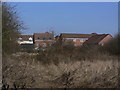
Waste ground near Ruddington
The open area between the gypsum works and the new housing off Pasture Lane has come out of agricultural use and is becoming quite overgrown.
Image: © Alan Murray-Rust
Taken: 7 Mar 2010
0.13 miles
5
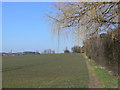
Hedgerow off Pasture Lane
Lining the backs of gardens of houses along Clifton Road.
Image: © Alan Murray-Rust
Taken: 7 Mar 2010
0.14 miles
6
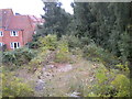
Old railway station platform, Ruddington
The platform of Ruddington railway station is still extant, though it is now quite difficult to see through the vegetation that has grown since the railway line was closed. It was on the Great Central Railway's London Extension (from Annesley in Nottinghamshire to Quainton Road in Buckinghamshire), and followed the standard pattern for stations on that line: an island platform accessed by stairs from a road bridge. The area immediately to the east of the station (presumably the site of the goods yard) has now been developed for housing (left).
Image: © Richard Vince
Taken: 23 Sep 2013
0.14 miles
7
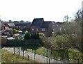
New development at Ruddington
Recreating this 'First' for the square https://www.geograph.org.uk/photo/182050
No longer quite so new!
Image: © Alan Murray-Rust
Taken: 18 Mar 2022
0.14 miles
8
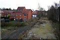
New houses at Ruddington
I have tried to replicate the view of Image
Image: © David Lally
Taken: 1 Feb 2010
0.14 miles
9
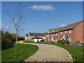
Tongue Way housing, Ruddington
The final stage of development to the east of Pasture Lane.
Image: © Alan Murray-Rust
Taken: 18 Mar 2022
0.14 miles
10
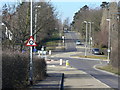
Clifton Road
A recently created roundabout at the junction of Clifton Road and Pasture Lane, due to the increased housing off the latter.
Image: © Alan Murray-Rust
Taken: 7 Mar 2010
0.15 miles