
IMAGES TAKEN NEAR TO
Stanton Road, NOTTINGHAM, NG10 5EN
Introduction
This page details the photographs taken nearby to Stanton Road, NG10 5EN by members of the Geograph project.
The Geograph project started in 2005 with the aim of publishing, organising and preserving representative images for every square kilometre of Great Britain, Ireland and the Isle of Man.

There are currently over 7.5m images from over14,400 individuals and you can help contribute to the project by visiting https://www.geograph.org.uk
Image Map
Images are licensed for reuse under creativecommons.org/licenses/by-sa/2.0
Notes
- Clicking on the map will re-center to the selected point.
- The higher the marker number, the further away the image location is from the centre of the postcode.
Image Listing (12 Images Found)
Images are licensed for reuse under creativecommons.org/licenses/by-sa/2.0
Image
Details
Distance
1
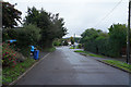
Stanton Road in Sandiacre
A road of detached and semi-detached houses on the edge of Sandiacre.
Image: © Malcolm Neal
Taken: 15 Oct 2019
0.02 miles
2
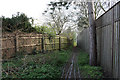
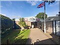
Garden and Motorway Fences
As the path becomes more constricted the garden fence becomes moss-covered.
Image: © David Lally
Taken: 14 Apr 2008
0.21 miles
4
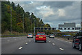
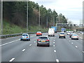
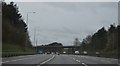
Erewash : M1 Motorway
The M1 Motorway between Junction 25 (Sandiacre) and Junction 26 (Nuthall).
Image: © Lewis Clarke
Taken: 30 Sep 2018
0.24 miles
7
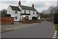
Church Street, Sandiacre
Looking along the northern end of Church Street from close to the Blue Bell pub.
Image: © Stephen McKay
Taken: 15 Mar 2015
0.24 miles
8
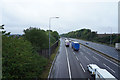
Looking north along the M1
A view from the other side of the bridge over the M1.
Image: © Malcolm Neal
Taken: 15 Oct 2019
0.24 miles
9
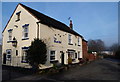
Church Street, Sandiacre, Derbys.
The Blue Bell pub on Church Street on the northern side of Sandiacre, close to the Parish Church. The black & white hooped bollards marks where the road divides into two. Church Street becoming Stanton Road around a left hand bend in the road whilst Church Drive descends towards the church and to where the 17th century village "lock-up and pound for stray animals" can be seen.
Image: © David Hallam-Jones
Taken: 16 Feb 2013
0.25 miles
10
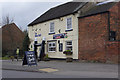
The Blue Bell, Sandiacre
This Sandiacre pub appears to have a strong sports theme, advertising live sports and with Guinness inflatable rugby posts by the front door.
Image: © Stephen McKay
Taken: 15 Mar 2015
0.25 miles